National Poetry Month- Does poetry matter?

"Does poetry matter?"

That was the title of a NYT Opinion Pages "Room for Debate" special in 2014. They featured seven commentators, all of whom were poets (you couldn't have picked unbiased non-poets, eh, NYT?) discussing the merits of poetry and the genre's place in today's world. Unsurprisingly, all seven landed on the side of "yes, it matters." But why does it matter? 

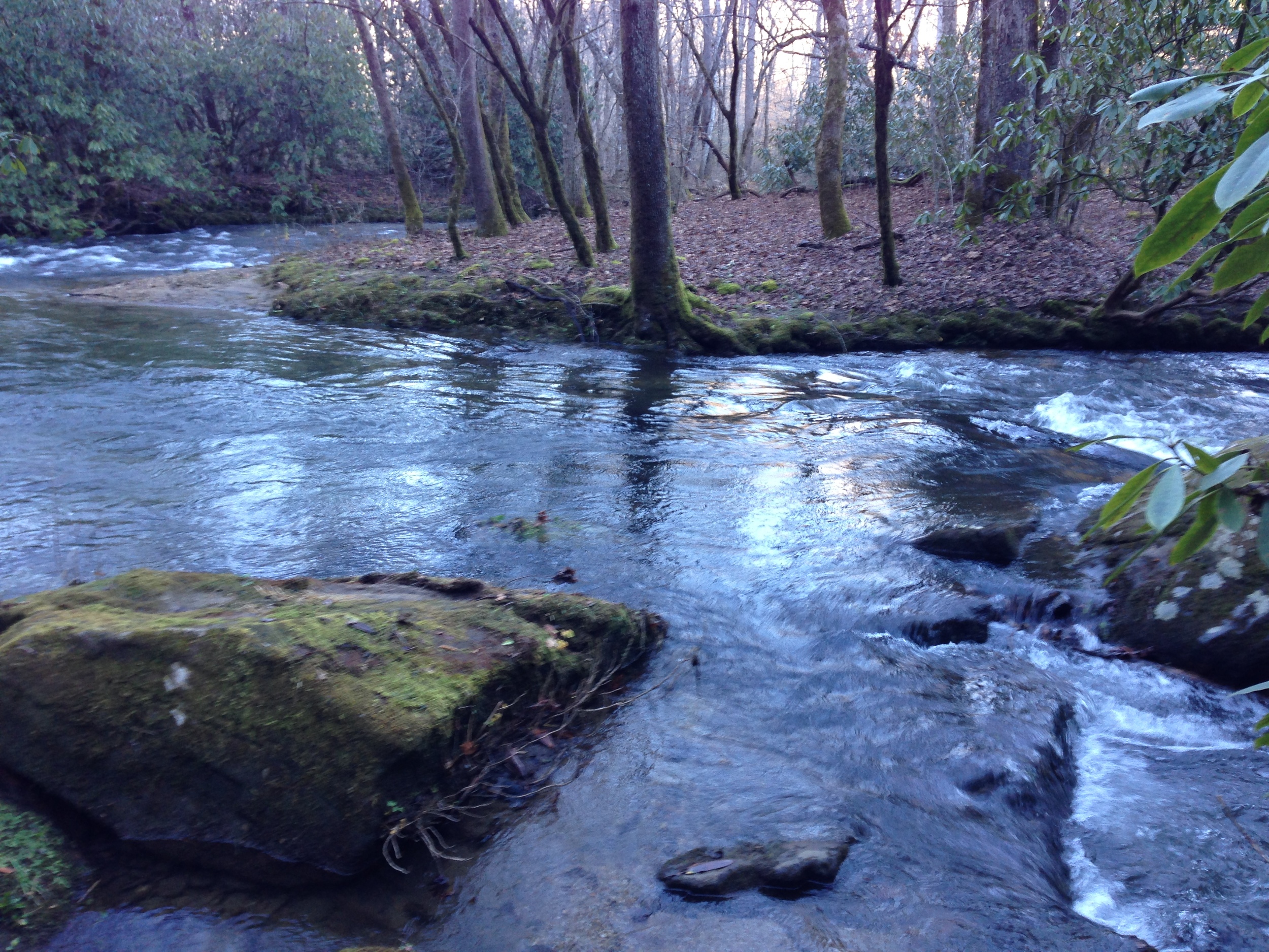
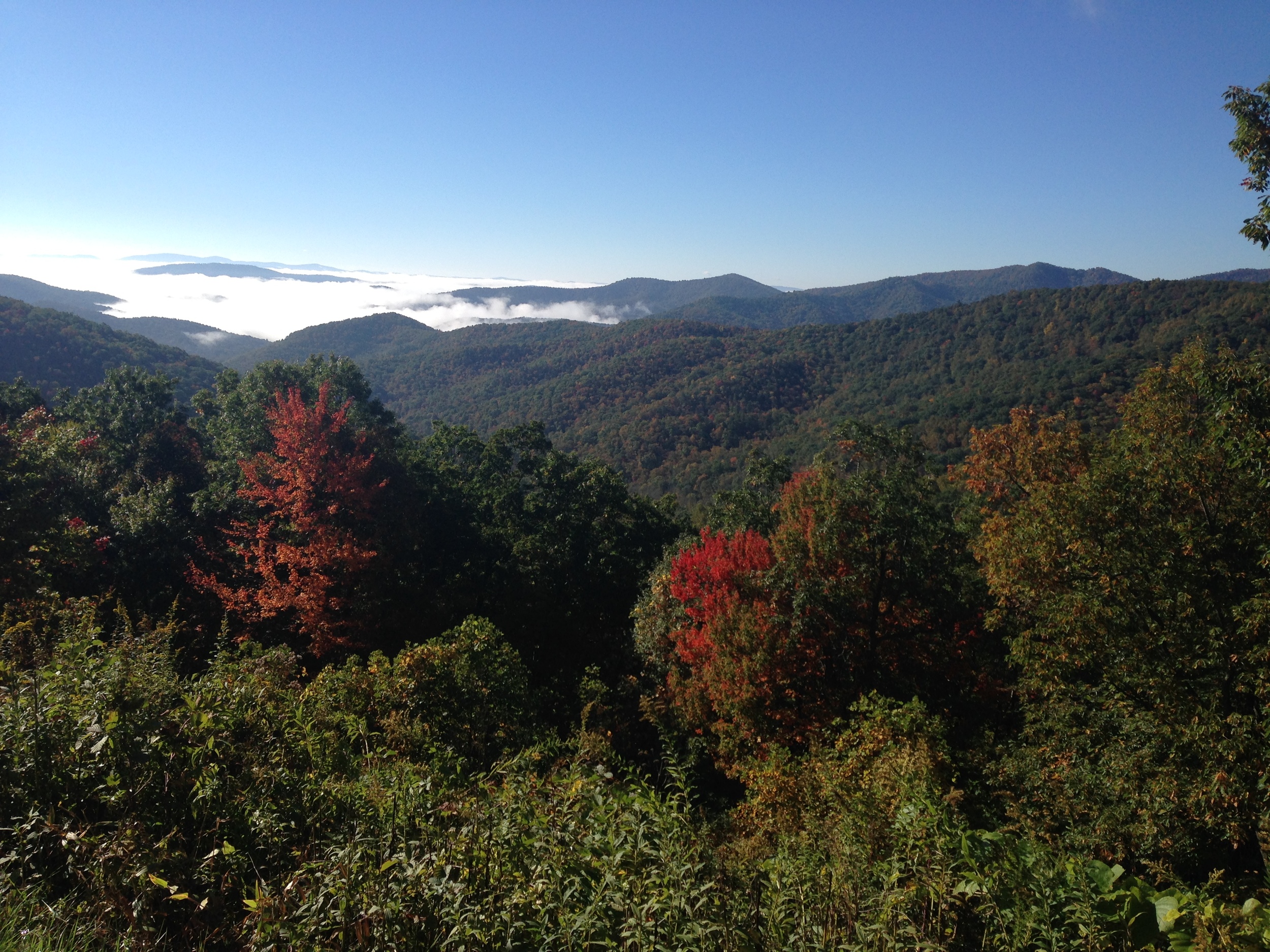
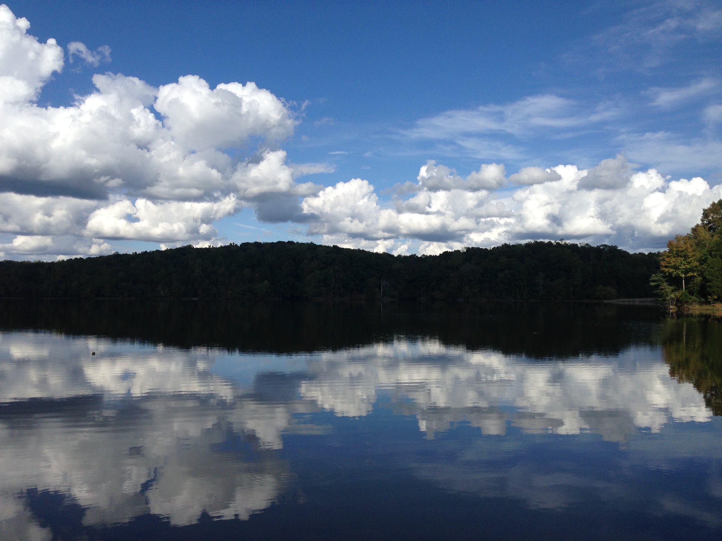
April is National Poetry Month. A time to debate and celebrate poetry. I'm sure there are, or will be, numerous articles and posts that continue to examine poetry's place and purpose. More than any other art form- whether it be photography, painting, or even other genres of writing-  it seems like poetry is always thrust into the "relevancy" conversation. 

Some people say, "I just don't get poetry." Maybe they were taught complex poems in high school that are from a different era, filled with precise rhyming schemes and lots of arcane historical or mythological references. It can be hard for a casual reader to understand, or even make it through, a poem that is loaded with images and references that the reader has never heard of.

Others may dislike poetry because some poets are purposefully obscure, in an attempt to seem "deep." Poetry is sometimes labeled "pretentious."  I think that's a fair criticism in some cases. Reaching for a thesaurus to replace "easy" words in your poems is a pitfall. Of course, a poet should use precise language. But that doesn't mean a poet has to use fussy or overwrought language.

To categorically say you don't "get poetry," and therefore to write it off, is a missed opportunity. I might be naive in believing that anyone, regardless of education or training, can appreciate some form of poetry. But I do believe that.

Every civilization has had poetry, even ones without written language. Oral traditions are a form of poetry. The sound of the words is critical in poetry; that's why poetry and music are closely related. Poetry can, and has been, used as a shorthand for larger themes and stories.

David Biespiel's response is spot-on, I think. He writes:

"In the same way that poems illuminate our individual lives, poems also help us understand ourselves as a culture. Or at least they spur us to ask the questions...
If we care about the deepest aspirations of men and women across every community and culture, language and race, then poetry is always relevant because it is the art of the utterance of what we share in our innermost psyches. 

Since culture and society existed both before we live and after we die, poetry is a link to our passage through our own time and a record of poets’ perspectives throughout time. 

We know that human beings are intrinsically connected to one another in how we assert our being. When we read a poem, we are in the presence of this link. We are open to the metaphors of our shared natures." 

So, to answer the NYT question: yes, I think poetry matters. But not because it's some grand artistic expression that requires the reader to have a PhD in literature. At its best, poetry is for everyone who wants to sit down and read it.

One last note - - - Though they were novelists, not poets, I think the famous exchange between William Faulkner & Ernest Hemingway gets at the heart of how we should think about poetry, and all writing.

Faulkner wrote, in reference to Hemingway, "He has never been known to use a word that might send a reader to the dictionary."

Hemingway's response? “Poor Faulkner. Does he really think big emotions come from big words?"


A few of my favorite poetry collections:

Lake-of-Two-Mountains-cover-with-sticker.jpg

Arleene Paré, Lake of Two Mountains

This volume is stunning. This Canadian poet's collection is "a portrait of a lake, a relationship to a lake, of a network of relationships around a lake." Paré's use of language is just perfect. She pairs words that I never imagined together. The way she describes nature, so seemingly banal and overdone in poetry, is somehow fresh. Here's the synopsis from the cover:  "It maps, probes and applauds the riparian region of central Canadian geography that lies between the Ottawa and the St. Lawrence Rivers. The poems portray this territory, its contested human presences and natural history: the 1990 Oka Crisis, Pleistocene shifts and dislocations, the feather-shaped Ile Cadieux, a Trappist monastery on the lake’s northern shore. As we are drawn into experience of the lake and its environs, we also enter an intricate interleaving of landscape and memory, a reflection on how a place comes to inhabit us even as we inhabit it."

Adrienne Rich, Dream of a Common Language

No list of major poets of the 20th Century would be complete without Rich. The content of this collection may not seem scandalous to modern eyes, but it was extremely controversial when it was published.

In 1953, Rich, who was educated at Radcliffe,  married a Harvard economist and ultimately had three children with him.

But, Rich was secretly a lesbian. She and her husband separated in 1970, and he committed suicide later that year. When Twenty-One Love Poems was published in 1976, it was her effective "coming out." The series addresses her lesbian desires, but the poems go beyond just describing a same-sex relationship. They are simply sublime.

Dreams of a Common Language was published shortly thereafter in 1978 and incorporates three parts; first, Power (which is also incredible, and which every woman should read;) second, the previously published Twenty-One Love Poems; and third, Not Somewhere Else, but Here. Rich eventually became not only a lauded poet, but one of the leading radical feminist activists of her time. 

William Carlos Williams

One of the best known American modernists. This is a good primer on his works. I like the selections from Sour Grapes, Spring and All, An Early Martyr, and The Wedge. Williams is more than just "The Red Wheelbarrow" or "This is just to say" (though those are both lovely, and good examples.)


Diane Wakowski- Dancing on the grave of a son of a bitch

My favorites are the series of "Astronomer Poems." They are a little "far-out" from things I would normally read. Wakowski is a "deep image" poet (yes, I had to Google that too...)

This volume is a little more accessible than some of her other stuff, but I still feel like I only half-grasp what she's talking about half the time. It feels like weird daydreaming (or sometimes, nightmares.)

But the title poem is so badass. It's a searing middle-finger to her "motorcycle betrayer." Hell hath no fury...


In the Heat of Shadows: South African Poetry 1996-2013, edited by Denis Hirson.

I bought this in Cape Town, South Africa in January 2015 when I was visiting a good friend who was serving in the Peace Corps in Lesotho (which is landlocked by South Africa.) It's a collection of post-apartheid poetry that shows a nation still grappling with identity, politics, and relationships to land and community- but from a different angle. 

The collection features poetry in English, Afrikaans, isiXhosa, isiZulu, Sesotho, and Xitsonga- some of the many languages spoken in South Africa. I haven't made it through the whole anthology (there are multiple works by 33 poets) but some of my favorite poets from it are: Karen Press, Robert Berold, Mxolisi Nyezwa, Ronelda Kamfer, and David Wa Maahlamela. 


On my "to-read" list:

  • Tracy K. Smith, Life on Mars- Smith won the Pulitzer Prize in 2012 for this collection. Her father was an engineer who worked on the Hubble Telescope, so the themes of "space" and "science" run throughout. This is the lead-off on the back cover: "With allusions to David Bowie and interplanetary travel, Life on Mars imagines a soundtrack for the universe to accompany the discoveries, failures, and oddities of human existence." If that doesn't pique your interest, nothing else will.

  • Rebecca Dinerstein, Lofoten- A bilingual collection of a year spent in the gorgeous archipelago of Lofoten, Norway.

  • Saeed Jones, Prelude to Bruise- Jones received pretty much unanimous praise for this debut collection in 2014. He writes about violence, race, sexuality, and living in the South, using a central figure (simply named "boy") and descriptions of "the body" to illuminate these topics. 


Spring Refresh: Tunes & Reads

Spring means all things new, fresh, and exciting. If you live in a place that actually experiences spring, that is. In Vermont, mud season doesn't exactly lend itself to feeling awakened. There is usually one gloriously warm burst in March, but then we slide back into almost-not--but-basically-winter. But down here in the Carolinas, the trees are green, the flowers have bloomed, and the weather is balmy. This is the first real spring I've experienced in years, and I am loving it ...

I thought I'd share some things I've been listening to, reading, etc recently. Not all of them are related to the South, but some are. Where I am physically or geographically in life usually influences what music and books I gravitate towards. When I head to Colorado in one month (coming up fast!) I am excited to look under to hood of the music & arts scene there and post my findings.


Tunes

Since I do album reviews for Seven Days, I am fortunate to get to hear a lot of new Vermont tunes. I love being able to keep a finger on the pulse of the VT music scene, even from afar. I just submitted a review for Burlington duo Cricket Blue's new EP, Io. I loved it. It is a stunning, complex piece of folk music that weaves tales old and new. It's not just a standard, boy-girl pair strumming their guitars. It's dark and rich. And man, those voices... The EP goes live on April 9th, so look for the review in next week's issue!

One thing I've learned is wherever you go, there is quality local music being made. You just have to find it. Read alternative newspapers and publications for the goings-on, hang out in coffee shops for open mic nights, or post up at a bar for late-night jams (or just post up at a bar in general, because why not?) 

Since I've relocated down south, I've been consulting Blue Ridge Outdoors, an outdoor adventure magazine and website focused on the Southeast & Mid-Atlantic. The online version offers a free monthly playlist called "Trail Mix" (clever, clever.) The site also profiles up-and-coming musicians, focusing on Americana-inspired sounds. Have a listen to March's mix here. They even featured one of my favorite artists, The Suitcase Junket (one-man band made up of the weird-instrument wielding Matt Lorenz.) He performed at Otis Mountain Get Down last year, and he killed it. He recently released a new album, Dying Star. Check it! 

Switching gears from rustic, rootsy sounds--- I've also been grooving to the polished, romantic beats on Fleurie's EP, Arrows. It was released in September, but I think it's perfectly dreamy for spring. Listen to the lead-off track, "Fire in My Bones." Yes, it was featured during a steamy scene on Pretty Little Liars. Yes I watch that show...moving on.

Last one. If you like 70s rock, you need to know Philly-based group,  Sheer Mag. Their don't-give-a-shit attitude and infectious riffs will keep you rocking all spring. Plus, lead singer Tina Halladay is as bad-ass as they come. The band leans toward the scruffier side of punk-rock rather than the aggressive end, so their tunes are still approachable for non-head bangers. A month ago they released a third EP, sequentially titled III, which is just as catchy as their earlier ones.


Reads

I always have a rotation of three or four books that I'm reading simultaneously. I usually read half of one, put it down, pick up another, get distracted, then open another, and so on. I always get around to finishing them but it's never in a linear, normal fashion. Oh well. I like having my brain engaged in a lot of different things and switching it up.

Here are some books currently on my shelf (or, more accurately, my floor, since I don't have a bookcase...)

  • 1959: The Year Everything Changed- Fred Kaplan. The mid 1960s are usually assumed to be the years of great upheaval in 20th Century American culture, politics, and life. But Slate writer Fred Kaplan posits that the seeds for the "revolution" were actually planted and nurtured in the last year of the 50s. Some of the major happenings in the year include: the invention of the microchip and the birth control pill; the advent of the space race; the rise of New Journalism, Motown, and free Jazz; the beginnings of school integration; the debate over publication of "obscene material" and banned books; the emergence of Fidel Castro and Malcolm X; the beginning of the "nuclear age" and the fallout-shelter phenomenon; the start of the Cold War; and the first casualties of the Vietnam War. All of these events would shape the latter half of the century. It's a fascinating read. Kaplan traces the circumstances of individual people, movements and events, tying them all together to make his case for why 1959 heralded a new age.


  • American Canopy: Trees, Forests, and the Making of a Nation- Erik Rutkow. Rutkow is a Yale scholar who is obsessed with trees. I'm not being cheeky when I say that. His book is, literally, a treatise on how trees shaped the history of the United States, from pre-colonial times to present. He discusses everything from early stripping of the forests for timber for home construction; to Liberty Trees and the American Revolution; to the Industrial Revolution and the need for wood for mills, trains, and coal production; to Transcendentalism and other literary movements focused on nature ; to the ubiquity of paper and pulp products; to the construction of city parks; to diasters like major fires and the chestnut blight; to the national parks movement and the creation of the federal bureaucracy of the Forest Service and the Department of the Interior; to the rise of modern environmentalism. He also explains how trees were important to major historical figures like Jefferson, Washington, and Teddy Roosevelt. For such a specific topic, Rutkow keeps the writing surprisingly engaging. It flows like a story---filled with eccentric characters, power struggles, and big themes.


  • Judgment Ridge: The True Story Behind the Dartmouth Murders- Dick Lehr and Mitchell Zuckoff. Dick Lehr is a renowned journalist and professor at BU, and I actually got to meet him a few weeks ago. He kindly gave me his book, co-authored with another BU professor and former Boston Globe staffer, Mitch Zuckoff. The community of Hanover, New Hampshire was rocked by the brutal slaying of two beloved professors in 2001. When it was discovered that two teenagers from Chelsea, Vermont had committed the crime, the shock extended into the sleepy, presumably safe confines of the Green Mountain State. The authors delve into the lives of everyone involved, describing the crime and subsequent investigation and trials, ultimately painting a vivid and disturbing portrait of the events. It's a true crime book, but it's more than just a simple thriller. 

Another recommendation from a book I read this fall: Badluck Way: A Year on the Ragged Edge of the West- Bryce Andrews. I love this book. It's a memoir about Andrews' time on a Montana ranch. But it's more than just a simple meditation on "western living." Parts of the memoir deal with Andrews' daily life as a ranch hand, fixing fences, roping cattle, and tending to the land. He elegantly describes the fierce weather and often unforgiving, but undeniably breathtaking, landscape. The central focus, however, is on Andrews' relationship to one specific animal, a wolf. During his time there, wolves began to pick off members of the ranch's cattle herd. After much back-and-forth, the ranch is ultimately issued a "kill order" to eliminate the wolves responsible. Andrews dwells on his hesitant pursuit of this one wolf, interspersing his own narrative with that of the wolf's. It's haunting. The book is technically about the life-and-death dance of one man and one animal, but more broadly, it raises questions (and not simply new age platitude-ridden ones) of humanity, conservation, land-use, and our relationship to our environment.

Last note. I just picked up Kim Gordon's music autobiography, Girl in a Band, and I am looking forward to digging in! But first, I'll finish the others...


"Winter" in the Carolinas

Moving from Vermont to South Carolina has come with many adjustments, but perhaps none as drastic as the weather. This time of year in Burlington, I would be trudging through the ever-present crust of ice and snow, bracing whipping winds and freezing temperatures. Spring would still be several months away (if it ever sprung at all.) Daylight would be scarce.

Not so in the Palmetto State. Granted, we had an inch or two of snow a few weeks ago and the city went into panic. Stores and restaurants were closed and the roads were impassable, with no salt or sand. I stayed home for 48 hours straight.

But on the whole, the "winter" here is incredibly mild, particularly in this El Nino year. A few days before Christmas, it was in the 70s. Now, in February, it's averaging 40-50 in the day, but sometimes it breaks into mid 50s and low 60s. Nights can be chilly in the 30s, but it still feels warmer than the cold snap of that Lake Champlain wind up in Burlington. Plus, daylight is almost an hour longer. 

This balmy climate means I can get outside a lot more often than I would living up north (since I'm not a skier, my Vermont winters were nearly 100% indoors.)

Here are some snapshots from some of my recent hikes and drives in South (and North) Carolina.


Crowders Mountain State Park, North Carolina // January 14, 2016

Crowders Mountain is just over the state line and actually connects to Kings Mountain State Park and National Military Park in South Carolina, which I visited this November. 

Inside the park office, visitors can read about the history of Crowders. In the early 1970s a mining company began exploring and collecting samples form the mountain, seeking to purchase the mineral rights. Grassroots efforts by local citizens and organizations persuaded the state government to protect the area and set it aside as a state park.

In 1973 the state officially designated the area as Crowders Mountain State Park and it opened to the public in 1974. The Pinnacle, the second peak, was added to the park in 1987. In 2000, the Crowders was officially expanded to connect with the Kings Mountain parks in South Carolina.

Crowders is generally less visited than the Kings Mountain parks, because it has more difficult trails. But after completing the summit hike to Crowders peak, it has become one of my favorite parks in the area.

crowders (1).jpg

I decided to do the Crowders trail, to the Rocktop trail, then the Tower trail to finally access the summit, and take the Backside trail on the way down to reconnect with Crowders. All together it would be about 6 miles roundtrip. 

Setting off from the Sparrow Springs visitor center, you walk the same trail to access Pinnacle and Crowders. Choosing Crowders to the right gets you on your way.

The first mile and a half of the Crowders trail is easy forest walking, over nice bridges and streams. Once you cross the park access road, you quickly come to the dividing point between continuing on Crowders proper and taking the steep, entirely rock-face trail- Rocktop.

I chose that one because the visitor center park guide advised me it's easier to rock scramble on the way up than the way back down, when you're tired and could make a false step. Apparently, this is no joke. Signs like this greet you when you reach the trail:

Comforting, no? The trail is red blaze, and you basically just have to hop, crawl, shimmy, and inch your way up and over various rock faces, keeping an eye on the blaze to make sure you're going in the general direction.

It was about 40 degrees when I started on the Rocktop trail. Within minutes I had shed my fleece and unzipped my jacket, wearing just a tee shirt underneath. There were a few people hiking before me and after me, and the struggle was universal.

This hike actually reminded me a lot of Vermont hikes like Camel's Hump and Mount Mansfield. Craggy rocks, scrambling, lots of careful hand and foot work. And lung work. Because you will be gulping air.

It's 1.4 miles on this trail, and although it was strenuous, I was glad I did it on the way up like the guide had suggested. While taking a little rest, I met a couple in their 60s, Mike and Sheila, who were doing a test hike to see if their WEDDING PARTY could make it up the mountain to a flat part of the Rocktop trail. Incredulous, I asked them why.

Apparently, this was where they had their first date, and where Mike proposed. So, they figured "why not get married on the mountain!" I was impressed and a little intimidated. 

They reasoned that many elderly members of the wedding couldn't make it, so they got a park employee to volunteer to drive some of the wedding party up an access road so they wouldn't have to do much hiking and could just hop out and walk a short ways. This is where the Tower Trail comes in. I met Mike and Sheila basically at the end of Rocktop, a short distance from the access road, which leads to the Towers on top of the mountain.

We talked and hiked our way along the Tower Trail and around the towers to continue to the summit overlook.

Mike and Sheila had only been dating for six months (!) and he had proposed after the first two months. They said, at their age, "you just know."

Their adult children, and young grandkids, would be coming to the wedding, along with their friends who "all think we're crazy," they laughed.

It was great talking to such an active and, yes a little crazy, couple. They are definitely living life their way. It was certainly inspiring! 


We made it to the summit and Mike and Sheila quickly scrambled off to explore more plans and trails for the wedding. I said goodbye, unpacked my lunch, and took in the view. You don't get a traditional sweeping summit view. It's more like pockets of overlooks, like the one above.

Cheesin'.

Cheesin'.

It was a clear day. You could see all the way to Charlotte, NC. And it had warmed up, in the mid 50s. Simply gorgeous.

I stayed for a bit, walking around and admiring the various overlooks. By now it was about noon and many people had reached the top.

After enjoying a leisurely lunch and liters (literally) of water, I was ready to head back down. I still had about 3 miles to go back to the visitor center!

Yikes.

Yikes.

And once again, I owe that park guide a thank you. The way down on the Backside trail begins with a series of 300 steps. I can't imagine going UP those on your final ascent to the summit, so I was grateful to be going down them instead!

The Backside quickly joins up with Crowders to loop back. It was a pleasant, easy woods walk. I ended back at the visitor center around 1:30, where I tried to ignore the large number of taxidermied animals. 

Double yikes.

Double yikes.

But all in all, it was a gorgeous and challenging hike. I will definitely be back to do the Pinnacle Trail, and maybe one day the 16 miler connector between Crowders Mountain and Kings Mountain.


Paris Mountain State Park, Greenville, South Carolina // January 18, 2016

I started off this day intending to hike the Raven's Rock Loop Trail at Caesar's Head State Park. But, I hadn't realized how high up the trail began. It was an 11 mile drive up a mountain pass, and when I got there, it was 25 degrees and icy. I wasn't too confident my car (grandpa's, with no four wheel drive and used tires) could make it back down the pass without having some ice-related fiasco. Plus it was truly cold and I wasn't dressed for those temps.

So I decided to head over to Paris Mountain near Greenville instead. I had to be there later in the evening to pick up my dad from the airport anyway, so it seemed right.

Lo and behold, the only way to remain in South Carolina and go to Paris Mountain is...to go back down Caesar's Head. So I just kept driving the opposite way over the state line. I stopped in Cedar Mountain at a little diner-cafe for some coffee and a map (no cell service means no GPS. Adventure!)

The woman at the register looked at me like I was a little nuts when I asked the best way to get back to South Carolina without going back over the mountain on Highway 276 South, which is the most direct route (and really the only one). She said, "well, you can keep going North on 276, and you'll reach Brevard, and you can hook up with a smaller highway, 64, there. It's backroads so as long as you don't mind a scenic drive."

Sold. I careened down 276, snaking my way toward Brevard, a mountain college town. On the way, I laughed as I stumbled across this:

Who knew? The things you find when lost, backroads, with no GPS.

Who knew? The things you find when lost, backroads, with no GPS.

I did indeed encounter Brevard about 10 miles later, connected with Highway 64 West, and headed back to South Carolina. I had to connect to 178 East, then 288 East. 

Welcome to Bob's.

Welcome to Bob's.

The woman was right about back roads. I was traveling through the country. And it was lovely. Valleys with morning mist still burning off. Streams off the side of the road. Advertisements for cabin rentals. Truckers at four way intersections, coffees in hand, arms resting on car windows. Tiny towns. And, possibly the greatest roadside bar I've ever seen.

Bob's Place, Sunset SC. Apparently, Bob's is known far and wide as a biker bar, local watering hole... and the site of one of the South's more gruesomely fascinating phenomenons: "you kill it, we grill it."

Fire it up.

Fire it up.

It was fairly early, about 11:00 am. Bob's didn't seem open. I kept driving but vowed to return.

Another two hours of back roads curling through the South Carolina upstate brought me around to Table Rock State Park, where I've hiked and camped. I listened to old country radio. I watched vultures pick apart road kill (that had luckily escaped Bob's.) I let the sun warm me through the windshield.

I reached Paris Mountain State Park near 2:30 pm. It had been a rag-tag day, so I opted for a short jaunt rather than a full hike. It was Martin Luther King Jr. day, so a lot of families were out hiking since the kids were off from school. The park was bustling.

I ended up doing just under two hours on the Sulfur Springs Trail, one of the more famous in the park. I plan to return and do the full loop one of these warm days.

There are multiple access points to the trail. I started off from one of the parking lots where I saw many people hustling on and off the trail. Nearby, there were group picnic shelters and former scout camp gathering spots.

The trail was woodsy and straightforward. I quickly reached the namesake, Sulphur Springs, and the dam. The smell was not terribly strong, but still noticeable.

School kids on some kind of group outing were scrambling all over the place at the dam, so I pressed on.

A little ways beyond the dam wall, there was a nice "beach" where you could admire the view. I kept going, figuring I could rest on the way back.

I hiked probably 45 minutes deeper into the woods. The trail narrowed in as I went. There were several stream crossings and small waterfalls to admire.

The trail picked up the incline and I was definitely feeling the workout. I rested and decided to head back. It was growing dark at about 4:00, since I was in a valley and under a thick tree cover.

Feet up and happy.

Feet up and happy.

I did stop and enjoy the view near the dam on the way back. The water, remarkably clear, was like a rainbow ribbon of green and blue.

By now, everyone had dissipated and I was alone. I dragged my fingertips across the chilled water, then perched on a rock to pass some time.

After about ten minutes of perfect solitude, I began the trek back to the car. 

I still had several hours before I had to fetch my dad from the airport. I did a quick change in the park bathrooms and drove into Greenville for some food. I ended up hanging at an open mic night at Smiley's Acoustic Cafe for a while, listening, munching, sipping, and chatting with the bartender. A good end to a rambling mountain day.

South Carolina Hikes: Croft State Park and The Cottonwood Trail

After relocating to Spartanburg, South Carolina, I was eager to get outside and explore the area's best hiking and camping spots. Conveniently, there is a state park in Spartanburg called Croft State Park, as well as numerous small hiking and nature trails. Here are three recent trails I've done.


Croft State Park / Fairforest Creek Trail, 3.5 miles/ Difficulty: Moderate / September 30, 2015

For my first South Carolina outdoor expedition I picked Croft State Park. This is a 7,000-acre park just outside of Spartanburg proper. The park is popular with equestrian enthusiasts, as it has many horse trails in addition to hiking and biking paths.

I wanted to get a feel for the terrain in a place that was less remote, with marked trails. I took a small REI light daypack with a granola bar and water bottle since I knew I would only be on the trail for a few hours.

I initially wanted to hike the Lake Johnson Trail, but I parked in the wrong place and wandered around for a half hour trying to find the trailhead. After setting out through the woods and coming into a surprise clearing by the horse stalls, I ambled across the ring to a road and found a 3.5 mile loop trail called Fairforest Creek. I took it, not sure of where it would lead.

Fortunately, it quickly delivered on its promise and brought me to the creek. A wooden bridge offers the chance to cross over into mountain biking trails, but I decided to stick with the hiker footpath.

Bridge over Fairforest Creek.

Bridge over Fairforest Creek.

The trail winds through the woods, hugging the creek bank, and joining up with park roads. It took about two hours round trip, traveling at a comfortable pace and stopping often to avoid large spiders—who had spun their webs smack in the middle of the trail. I don't know what it is about the South, but these were some serious spiders, much larger than any I had seen in Vermont! I was not looking to get up close and personal, so I usually walked around the central footpath if I came across a big web strung across the trail.

The trail was hopelessly waterlogged and muddy. After 10 days of rain and the damage from Hurricane Joaquin, this was the first sunny day, but the ground was still saturated. I slogged through, and definitely took a few spills on some muddy inclines.

On my return loop, I stopped near the bridge to dip my hat and feet in the cool water. I desperately wanted to swim, as it was muggy and damp under the thick forest covering. I meandered the creek bank and splashed a bit, before packing up to walk away. Out of the corner of my eye I spied a rope swing on the opposite bank. Aha!

I crossed the bridge and scrambled down the rocks. I threw off my backpack and stepped out to grasp the rope swing. The water was not very deep, maybe three feet, so this couldn’t be called a proper swimming hole. Nevertheless, I jumped in and splashed around. Refreshing!

Rambling creek.

Rambling creek.

I was lucky enough to catch a look at a doe and her fawn on my way back. They were lurking across an open field, keeping close to the edge of the forest. I stopped, staring at them across the field. The fawn leapt away quickly, but the mother stayed, watching me for a few minutes before taking off.

The trail loop ended back at the parking lot of Lake Craig. The clouds were large and fluffy, reflecting perfectly in the glassy lake surface.

All in all, a good introduction to the Croft trail system. 


Cottonwood Trail / 3.5 miles/ Difficulty: Easy/ October 6, 2015

The Cottonwood Trail is part of the Edwin M. Griffin Nature Preserve. The preserve protects a stretch of Lawson Fork Creek and the surrounding area. There are several trails, all rated fairly easy. I decided to try the Cottonwood Trail, a 3.5 mile loop. Beginning at the parking lot, you see the trail map to guide you.

Walking along the Cottonwood Trail.

Walking along the Cottonwood Trail.

Sculpture near the trailhead.

Sculpture near the trailhead.

I only had about 1 1/2 hours, so I didn't end up doing the entire trail. Plus, it was miserably flooded in many places, still from Hurricane Joaquin. 

So, it was short, and more of a walk than a hike, but still beautiful in places. This would be ideal for a quick trip to recharge mid-week. Plenty of people run or jog these trails as they're nearly flat.


Rocky Ridge Trail: 3.5 miles/ With connections to Foster Mill Trail, total of 4.5-5 miles / Difficulty: Moderate/ October 7, 2015

Bridge crossing.

Bridge crossing.

This was my first hike trying out my own fully-loaded backpack. I’ve done long day hikes where I didn’t need sleeping gear, and have also done lots of camping, but I have always done camping by canoe or car where you can pack extra gear and not worry about weight.

I needed to test myself on carrying a 20-25 pound load on my back for backcountry hike in/hike out camping, and to do so on a relatively easy/moderate loop trail. A 4-5 mile day hike was a good test run, so completing Rocky Ridge with a few add ons would suit my needs.

I fully loaded my hiking backpack with all the necessary gear for a weekend to test how it felt. I have an Osprey Kestrel 38, which is ideal for long day hikes or light overnight/ weekend hikes. For multi-day trips, I plan to use my dad’s much larger Osprey Argon 85, which he took to the Australian outback.

The pack itself weighs 3 pounds. I was already wearing one pair wool socks, one synthetic tshirt, one pair cropped leggings, hiking/walking shoes, baseball hat, and a synthetic sports bra. In the pack went: sleeping bag (Marmot 30 degree, 3 lbs 14 oz), tent and poles (Marmot Limelight 2 person, 4 lbs 10 oz), stove and fuel (MSR Pocket Rocket, 3 oz for stove and 4 oz for fuel), cooking system (pot, nesting mug and bowl, utensils, ), one long synthetic pullover shirt, one coldweather synthetic legging, one pair wool socks, one pair synthetic underwear, one synthetic sports bra, first aid kid, headlamp, small toiletries, rain jacket (Marmot), rain cover for backpack, large knife, bandana, and Tevas for camp shoes/lounging. So for all the clothes and small gear I would guess another 2 or 3 lbs. Total of about 12 lbs.

For late fall or winter I would use a wool knit camp instead of a baseball cap, add a long sleeve thick fleece, and swap a long sleeve/long legging instead of the tshirt/cropped leggings I was wearing. I would also wear a bigger ski-type jacket instead of the thin rain jacket

The Osprey also has an integrated hydration pouch, so my 3 liter Camelbak (8 lbs of water) could fit right in. I also tucked a 40 ounce Klean Kanteen water bottle (2 lbs of wter, 9.7 oz bottle) in a side pocket. I could also have fit another water bottle if I chose. I’ve yet to acquire a water filtration or purification system, so at this point anything beyond 2 days would be pushing it. That's 10 lbs just for water.

So rounding off, the pack was about 22-25 lbs. I did not include food, but for a weekend hike I could keep it reasonable by bringing dehydrated, instant meals. That would add more pounds. It definitely felt heavy (perhaps heavier than 25) and I will learn to reduce weight for sure.

Back to the hike.

Rocky Ridge bears off of Foster Mill just past the Kelsey Creek Bridge crossing and is open to both horseback riders and hikers. The trail hugs creeks as it makes it way to the historic Whitestone Springs Spur Trail. This spur trail offers a one way route to the historic location of Whitestone Springs.  According to Croft's website "Trail users venturing to this location can view the spring and see evidence of the bottling business, several foundations, and the foundation of the 4 story hotel from the late 1800’s. This trail is a must if you really want to immerse yourself in the rich history and tranquil beauty that make Croft State Park so special."

I ended up doing the entire Rocky Ridge and adding on some connections to Foster Mills, but did not do the out and back to Whitestone Spur. I would guess 5 miles total, with Rocky Ridge being 3.5 and another mile or so with my connections. 

I saw a lot of wildlife, including two deer, a doe and a buck! I saw them again together, and then the doe a third and fourth time! I spied a green lizard and more big spiders (must be a Southern thing.)

The best wildlife sighting was, by far, this stunning blue butterfly. This butterfly was spectacular, and not at all humble. It showed off its wings for over five minutes, gently breathing and beating them slowly, open and close, open and close, so I got a good look at the pattern. Royal blue pattern on the inside that fanned to light blue at the wings' edge. 

I saw it on my way back down the trail, on the  Foster Mills connection. I was feeling frustrated and a little frazzled from various things, and the interaction with that butterfly really snapped me out of it. It was so peaceful to just watch it flutter around and show off. 


History of Kelsey Creek.

History of Kelsey Creek.

Lots of lovely plant life too. I have no idea what these berries were or if they were edible, so I just admired them instead of sampling them.

So those are three trails I sampled in Spartanburg, in a one week period. I was feeling good and ready for some bigger challenges...I started planning some trips into North Carolina to bigger mountains and more intense, diverse trails. Posts about those trips coming soon!

Cape Cod: Back on the Sandbar

End of Summer Day-Trip to Provincetown: Monday, September 21

I spent a little over a month at home on Cape Cod, from early August to late September (minus a ten day excursion north to VT and NY. Read about that in my previous posts on Saint Regis canoing and Otis Mountain Get Down!)

One of the highlights of being home was a day trip to Provincetown, a town that I knew from high school sports and occasional trips, but didn't know all that well. It was neat to see some of the attractions in mid-September after the crowds had left. Sometimes being a tourist in your own area is exciting, and can bring you new perspective.


I've been to Provincetown (P-town as it is affectionately called) numerous times, but there were several noteworthy things in Cape Cod's oldest town that I've never done. I was moving to the South soon, and there were two things I wanted to experience on the Cape before I left. 

The first: climb the Pilgrim Monument. Yes, contrary to popular belief, the Pilgrims landed in Provincetown first, then journeyed across the bay to Plymouth. In 1910, a 252 foot tower was completed to commemorate the first landing and educate the public about Provincetown's role in early American history. Elementary and middle schoolers all over Cape Cod and Massachusetts have climbed this monument, but even growing up here, I somehow never did. 

The second: spend one last afternoon at Race Point Beach and the tip of the Cape. Part of Cape Cod National Seashore, this is Provincetown's main beach, and its lighthouse marks the tip of Cape Cod. From there, the Atlantic Ocean stretches over to Portugal. So, you can't go much further than the dunes on Race Point.

The last time I had been there was two years ago, when one of my best friends from high school (Kara) was about to leave for the Peace Corps. She left in October 2013 in the middle of the government shutdown, and I was back on Cape for another friend (Sophia's) wedding, and to wish Kara good luck on her two year journey. We decided to go to P-town for the day. On our way to Race Point, we found the National Seashore closed! By order of the shutdown. We saw plenty of cars ignoring this, so undeterred, we drove through anyway.

As fate would have it, this time, two years later, I had the perfect vehicle for this journey. Kara's mother had acquired a seasonal second car, a crisp blue BMW Z3 Roadster, standard transmission convertible from 1999. The car was essentially in mint condition, and I had borrowed it a few times. I asked to have it for the day for one last Cape jaunt, and she graciously said yes. It was time to roll the top down and hit the open road!

Just look at it. It's a beauty.

Just look at it. It's a beauty.

It had been a while since I'd driven a stick shift, and I forgot how exhilarating it is. Especially in a convertible. It really doesn't get better than that. 

I grabbed a bagel and some coffee, heading up to P-town via Route 6. It's about 45 minutes from Chatham, and once you get to the outskirts, the road opens up into sweeping dune and ocean views on both sides.

It's one of the most stunning areas of the Cape. If you have the appropriate vehicle and permits, you can off-road, or get taken out in a dune buggy by a (likely overpriced) tour company. 

My first stop was the Pilgrim Monument. It was completed between 1907 and 1910, when President William Howard Taft dedicated the final 252 foot product (which rises about 350 feet above sea level.) Interestingly, it is the tallest all-granite structure in the country.

In front of the monument is an observation area with benches for relaxing and admiring the view. The monument faces the harbor, so it is part of the inner "wrist" of the "arm" of the Cape, curling toward the bay.

The sky was just perfect on this day: clear and bright blue. 

The Pilgrim Monument standing tall and proud. Yes, this is no-filter.

The Pilgrim Monument standing tall and proud. Yes, this is no-filter.

It takes about 10 minutes to walk up to the top of the monument. Along the way, stones are carved with names and dates of Massachusetts towns.

When you finally (and breathlessly) make it to the top, all of P-town lies before you. You can see all the way out to the ocean, noting the harbor. The high school (now defunct and since regionalized with other schools) sports fields lay behind the monument. I spent about 15 minutes up there, taking panoramas and just breathing in the view. It was sunny, but fairly cold! The top of the museum does have rails and window guard bars, but it is exposed to the wind. And it whips through!

View to the left of the monument, if you are facing the water.

View to the left of the monument, if you are facing the water.

Climbing back down, I stopped in the museum at the base of the monument. It houses artifacts of Cape Cod/ early American history, including taxidermied animals, such as polar bears, that were killed on expeditions leaving from Provincetown. Most of these animals were obtained on missions lead by the Provincetown-born arctic explorer Donald Baxter MacMillian.

Much of the museum focuses on the Pilgrims, the Native Americans who inhabited the area, and early-era settlements. Other exhibits display nautical charts, fossilized marine life, and artifacts from ships and buildings at the time. The once-booming whaling industry is also highlighted.

Old-time map on display in the museum.

Old-time map on display in the museum.

For me, it was particularly interesting to learn about P-town's history as an artists' community and writer's haven. Tennessee Williams wrote parts of The Glass Menagerie and A Streetcar Named Desire in P-town; famous playwright and poet laureate Eugene O'Neil spent time here; and Norman Mailer is even buried in the town cemetery. Other notables who passed through included Kurt Vonnegut and Jackson Pollack.

Today, the Provincetown Fine Arts Work Center sponsors artists' and writers' residencies and fellowships. P-town is also known as one of the best artistic and cultural towns on Cape. The Art House, International Film Festival, and the Provincetown Playhouse are popular spots. And, of course, there is the annual summer Carnival. The Carnival is an enormous parade/party that celebrates P-town's history as an LGBTQA community. It was formed to encourage and support LGBTQA tourism, and now it's one of the biggest-attended events on Cape Cod (it attracts 90,000 people!)

I meandered through the museum exhibits for a bit before hopping back in the car to head to Race Point, around noon. Going into the national seashore, you pass through a cover of trees and wind through the typical sandy Cape roads.

Since it was after Labor Day, the beach would be fairly empty...and there would not be a fee! I pulled into the parking lot and grabbed my towel, heading for the beach.

There were a few clusters of people enjoying the day. It was 65 and sunny, windy, and clear for miles. The Atlantic stretched out beyond the line of sight- endless, blue-black, and dotted with whitecaps.

I was the only one who went for a "swim." By swim, I mean wade. The waves were thunderous and unsafe to swim in, so I splashed around the shoreline and got up to my waist with some of the bigger waves. Surprisingly it was not all that cold, for straight-up Atlantic water- but people nearby probably thought I was crazy.

Naturally, I took some film pictures that I have yet to develop...so take my word for it: it was every bit the perfect "end of summer, goodbye Cape Cod" beach day.  I stayed for about two hours, soaking in the sun and salt spray, tracing the foam with my toes, watching seals tumble in the waves. I have always been a water lover. I am a Pisces, after all. I'm the one who goes straight for the water and stays in until leaving time, pruned, sopping wet, and utterly delighted. 

I had to return the car by 4:00, so at about 2:00 I (unhappily) left the beach for some lunch. I relished the drive back to Chatham, giving the sweeping dunes one last, longing look. It was goodbye, and it was harder than I predicted. Anyone who has spent time on the Cape can attest to its magic. I wanted to hold onto that for a little bit longer, but like anything, you have to learn when to let go, and be thankful for the time you called a place home.

Here are a few snapshots of some other Cape wanderings:


Canoe Camping in the Adirondacks: September 2015

Hey folks. It's been a while since I posted, so I want to catch up on the last few months of adventures! We'll start with a four-day canoe camping trip in the Adirondacks, just before Otis Mountain Get Down. 


September was shaping up to be a great time. In the course of writing part one of a two-part series on Otis Mountain Get Down, a music festival in Elizabethtown, NY, I had spoken with a few of the guys who run the show. They invited me to arrive at the mountain a few days early to meet in person, learn about the preparation and work that goes into the festival, and just hang out. They told me to show up anytime on Tuesday or Wednesday, with the festival beginning Friday September 11.  

As I was currently on Cape Cod, I knew it would be a bit of a journey to get to Otis, which is in upstate New York. So, I figured I might as well make a week of it, visit some friends in Vermont, and do some camping in the Adirondacks near Otis! I bought a bus ticket to Vermont for Friday September 4, with plans to meet up with a good friend in Burlington and begin a four day canoe camping trip that Saturday. We would then mosey over to Otis on Tuesday September 8. 

If you are a person who likes the remoteness of backcountry camping, but are less keen on the concept of counting the ounces of weight in your pack, strapping days' worth of supplies on your back, and walking or hiking to site miles from your car, then canoe camping might be your solution. It's advantageous because you can load up your canoe with all you need (or, as we are wont to do, far more than you need), and the canoe will do most of the work for you. You can move tons of gear and provisions in a relatively quick manner, paddling about 2 miles per hour. Another benefit is you can pack a lot of drinking water, so if you don't have a filtration or treatment system, you don't have to worry. Lastly, the canoe can help you reach remote, solitary campsites, and sometimes you'll have a lake or pond all to yourself.

We had canoe camped earlier in the year at Chittenden State Reservoir in southern Vermont and were ready to give it a second try. Knowing that we wanted to be relatively close to Otis Mountain, but really get away from the crowds on Labor Day weekend, we selected Saint Regis Canoe Area.

The Saint Regis Canoe Area is both the largest wilderness canoe area in the Northeastern US (encompassing 19,000 acres,) and the only designated one in New York state. It is closed to motorboats, so visitors must access its 58 bodies of water by canoe or kayak. 

There are developed campgrounds and some day use areas, but much of the area is known for excellent primitive camping, where one must paddle out to a site on one of the lakes or ponds. Some sites have fire rings, while others do not. None of them have standard amenities like restrooms or picnic shelters, and Leave No Trace principles apply.

The area is beloved by canoers who want to attempt strenuous, multi-day canoe trips, such as the famed Seven Carries or Nine Carries routes. Almost all of the water trails require a portage, or carrying the canoe over land from one body of water to another. 

We had an enormous 16 foot wooden canoe, which is not the ideal vehicle for multiple portages. We decided to put-in at Long Pond, one of the larger ponds, and set up a base camp at one of the primitive sites there. From Long Pond, we could paddle to nearby Turtle, Slang, and Hoel Ponds with minimal portages, mostly traveling through the water. Long Pond also features a trailhead to the summit of Long Pond Mountain, so it seemed like a perfect spot from which to explore the region.


Day 1: Saturday, September 5

Geared up.

Geared up.

With the car loaded and the canoe nested on the roof rack, we set out for the mountains in the morning. It was about a three hour drive (120 miles going 40 mph most of the way) to the St. Regis Canoe Area. Rather than taking one of the two ferries (from Plattsburgh or Charlotte) crossing from Vermont into New York, we elected to take the Lake Champlain/Crown Point Bridge. It added a little time to our trip, but were rewarded with no wait in line, and majestic views.

Crossing into New York, we hopped on state road 9N. Traversing it for roughly 45 miles, we passed through a smattering of lake towns: Port Henry, Moriah, Westport. New York lakeside towns are different than those of Vermont. While Vermont hamlets like Vergennes are quaint and filled with cafes, shops, and apple orchards or syrup stands catering to leaf-peeping tourists, the New York side feels forgotten, melancholy. Many towns are rundown, gray, almost lifeless-  like an aging horse left out to pasture. I felt intrusive, like I was watching something slowly recede into the ground.

It was a warm day for September, unusually so-  in the 70s. The roads were empty, with kids back in school and parents at work. The leaves were just beginning to turn, their verdant tips hastening to become brighter shades, but still not quite yellow.

Riding shotgun, I put on Springsteen's Born in the USA. We were not in working-class New Jersey in 1984, but it felt right. I'd been listening to that album often that summer, for reasons indescribable but also perfectly clear. Like any other young person, I had been idealistically, and maybe foolishly, dreaming of road trips, big skies, small-towns, and the "American experience." There is, of course, no such thing. At least, not in the universal, cinematic, one-nation-fits-all sense. And the title track is too often misinterpreted as a celebratory anthem, when really Springsteen had penned a middle-finger to the United States government and the Vietnam war.

Maybe it was the quieter songs that resonated. "My Hometown" made me think of the many homes I was leaving behind. Mostly of my adopted home of Burlington, where I had spent four dizzying, far too fast years at UVM, and two years after in the working world. I was a straggler, a townie, clutching onto all of Vermont's charms, trying to sap all I could before I inevitably fled. Then there was my teenage home of Chatham, Cape Cod in all its white sand, deep blue ocean beauty. There was also my non-geographical home of my closest friends in Vermont. I was soon moving to the South, which in some ways is another home, an older home where I was born and where my family is from. All these muddled "homes" were on my mind.

I'd always felt a special pang when I heard "Dancing in the Dark." It reminded me of nights at Manhattan's and Nectar's in Burlington, listening to a college friend's honky-tonk band kick up the dust. Now that I had permanently moved from Vermont, and knew this would be my last visit for a while, it was bittersweet.

En route, with the canoe hanging over the hood.

En route, with the canoe hanging over the hood.

With Springsteen coming through the speakers, and nostalgia on my mind, we swung through Elizabethown, giving it a once-over and promising to be back in a few days. We headed northwest, passing through Keene to stock up on provisions at Lake Placid.

Entering Lake Placid, you are transported into a world that seems never to have left the early 1980s. Driving into town, the enormous Olympic ski jumping complex imposes itself, pressing into your line of sight. The twin jumping towers rise up like alien antennae probing the sky. To me, they seem domineering, industrial, cold. To others, they bring to mind the excitement of some of the state's finest winter sports at nearby Whiteface Mountain.

The town itself is a tourist mecca, still cashing in on its Olympic glory 35 years later. Designed in the requisite Adirondack state park colors of yellow and brown, signs point the way to historical sites and Olympic lore. This is the land where the "Miracle on Ice" happened, a moment of glory at "defeating" the Soviets. Born in the cushy year of 1991, after the wall of the Berlin Wall, none of this is part of my cultural consciousness. It is like passing through a frozen time.

We stopped at a grocery store to pick up food and booze for the trip. Unable to find our preferred brand of plastic bottle whiskey (Canadian Hunter), we settled for Evan Williams, grabbed some Yuengling cans, and got back on the road. In twenty minutes, we were in the town of Saranac Lake. 

The Saint Regis Canoe Area is accessible from a few different put-ins and towns in the upstate region. Our chosen location of Long Pond required us to pass through the Saranac Lake wilderness and drive several miles down a small dirt road- Floodpond Road-  through developed campgrounds, until we passed over some railroad tracks and officially entered the canoe area. There were plenty of people staked out at the campgrounds for the long weekend. We grew a little concerned that we'd have trouble finding a remote spot when we found several cars at the put-in parking lot.

Turn for the Long Pond put-in. 

Turn for the Long Pond put-in. 

We shuffled the canoe down to the water first, then hoofed our gear down. We hit the water at about 4 pm. We intended to stake our claim at some of the northeastern campsites, numbers 11, 12, or 13. We paddled from the put in past site 1 and to our left, skirting sites 2 -5 on the western edge of a skinny neck part of the lake. We saw many of the sites already occupied and others were closed to allow for regrowth, so we continued as planned to the further sites. But, we found that 13, 12, and then 11 were also closed. A bit frustrated, with the late afternoon sun beating down on us and the hours of daylight dwindling, we backtracked across the pond near site 10.

Map of campsites on Long Pond, via New York state's DEC website

Map of campsites on Long Pond, via New York state's DEC website

We saw two kayakers and paddled over to ask them if they knew of any open sites. They told us to keep going past site 10 and shoot for one of the three open sites (numbers 6, 7, and 8) that were located a small, western inlet near the mountain trailhead. Relieved, we hustled over. By now we had been on the water for two hours and were anxious to set up.

Site 6 was entirely swampy, so we explored site 7 before finally settling on 8. We scurried to set up camp and get dinner going before dark. It was nearly 7:30 when we relaxed and began cooking.

Keeping warm.

Keeping warm.

The forecast for the next two days was clear and dry, so we decided to forgo using our rain fly and enjoy the night sky and cool air. We built a fire and settled into the woods. I was surprised how loud each little sound seemed.

Day 2 : Sunday, September 6

Morning came soon, since our tent directly faced the eastern sunrise. We stayed in the tent for a bit, listening to birds (perhaps cranes) stomping through the forest, searching for grubs. 

We decided to spend the day exploring the nearby ponds, paddling and swimming wherever we fancied. We left the majority of our gear at camp, loading the canoe with a small cooler of beer, water, and snacks for the day.

We retraced our steps from the previous evening's frantic paddle, this time taking it slow and admiring the landscape. We passed several loons, who were largely unafraid to get close and say hello. Or, perhaps they were getting close to make sure we knew this was their territory, not ours.

Large tracts of Adirondack wilderness, like the Saint Regis area, are ideal for loon viewing because the birds breed along the waterways of lakes and ponds. This day, they floated along serenely, black and white plumage gliding across the water. We happened to see a mother loon and a few baby loons. They spied us, approached, then turned around and dove under instinctively. 

We also saw several groups of people out on the water. What struck me the most was how we were twenty miles, by canoe and then by slow driving on a dirt road, from anything of consequence. And yet, a tiny band of weekenders had all landed here. It was comforting, but we also secretly craved the solitude we had expected. In due time, we would find it.

On our paddle we were surprised, and excited, to find that site 2 was now unoccupied. This was a gorgeous site in an excellent location, on a peninsula with east and west facing views, a good breeze, and sandy beach. We disembarked to have a look around. Since we had two nights left, we contemplated moving to this better site. Our current one was alright, but very far from most things, a little swampy, and had minimal views or a good swimming place. Permits are only required if staying in the same site for three nights or more, so we were clear there. We chewed it over for a few minutes, deciding if it was worth spending a few hours to move. It was.

Take two. Our second campsite, with our Marmot tent, canoe...and some fun floats peeking out.

Take two. Our second campsite, with our Marmot tent, canoe...and some fun floats peeking out.

We hustled back to our camp, about a 45 minute paddle. We broke down camp quickly and got back in the canoe in another 45 minutes, so we finally arrived and set up new camp in about 3 hours from finding it.

It was nearing 4 in the afternoon, so we still had some daylight left. Tired from our ambitious paddling, we spent the afternoon playing in the water and sipping Yuengling. 

Later, we made stuffed peppers with rice and beans, and grilled corn on the coals. The night was clear and calm, so the rain fly stayed packed and we got some spectacular views of the sky. With no light pollution, you can really get a look at the whole cosmos, and individual constellations or clusters. I found myself wishing I remembered more from my astronomy class sophomore year of college.

Late afternoon sun through the pine trees.

Late afternoon sun through the pine trees.

Day 3: Monday, September 7 (Labor Day)

This was our hiking day on Long Pond Mountain (3.2 miles roundtrip), and it dawned hot, in the 80s. Whatever was keeping the Adirondacks so warm this time of year, I was thankful for it. We didn't have to worry about frost, and we could enjoy swimming in the pond.

It was about an hour paddle to the hiking trail, and we got going around 11 am. On our way out, we noticed that every campsite was cleared out. We were alone. It brought a calm peace, knowing we still had a full day and night ahead, and could enjoy the pond in solitude.

We nosed into the trailhead and pulled up the canoe. The land immediately by the water was marshy and thoroughly muddy, but in a few steps we entered the typical thick Adirondack pine forest. Soft ground under our feet, we began the trek, reaching Mountain Pond, about twenty minutes into the hike. We admired it briefly before continuing on up the summit trail. It was relatively short, a little over an hour. Steep in places, with rock scrambles and lots of protruding roots. We, admittedly, stopped several times to catch our breath.

When we finally got to the top, it was about 1 pm. The sun radiated Indian summer glory. We unpacked lunch and sunned on the rocky summit, admiring the far-reaching views. The entire Saint Regis area spilled out beneath us.  We identified nearby ponds to the Southeast: Turtle, Slang, Hoel- as well as Upper Saranac Lake-  and gazed at the cobalt and evergreen blur of distant mountains and waterways unknown to us. 

We lingered for an hour, enjoying the total isolation and bird's eye view. We felt like loons, perched and observant. Dozens of electric blue dragonflies zipped around us, darting to and fro, landing on a branch or rock for the briefest of moments before taking to the wind again. We must have counted fifteen or twenty. A few butterflies meandered through as well.

On our descent, we did pass a middle aged couple heading up the trail. Once we hit the water, we saw they had claimed a campsite. And then, there were four, I thought. 

Back at camp, we enjoyed our last afternoon of swim time. We let the sun sink low, chilling ourselves for two or so hours before finally climbing out. 

View to the left (northeast-ish) from campsite 2.

View to the left (northeast-ish) from campsite 2.

Unfortunately, we had to put the rain fly on, as the sky portended a shower. It did rain all through the night, but we didn't mind too much. Sometimes a rainstorm clears the mind.

Day 4: Tuesday September 8

Our time at Saint Regis came to an end all too soon. Waterlogged from the night's storm, we made a quick breakfast, stowed our damp gear, and packed up. We paddled against a strong headwind back to the put-in, taking a while to work our tired arms.

We were a little cranky getting everything back uphill to the car, loaded, and strapped down. Things take longer than expected, and it happens, but it's easy to get frustrated.

We stopped at nearby Fishpond Campground for a shower, some dishwashing, and water refills before heading into the town of Saranac Lake. We gobbled deli sandwiches and checked emails while doing our laundry at a local wash spot. 

We resupplied and headed for Otis Mountain, winding back the way we had come, through Lake Placid, Keene, and ultimately to Elizabethtown. On the way, we pulled over to a spectacular river spot.

Tree in relief, etched against evening sky. Quite the spot.

Tree in relief, etched against evening sky. Quite the spot.

We ultimately arrived at Otis around 6 pm. We spent then next three days and nights hanging out with the crew and helping with last minute tasks for the festival. I won't spoil all their secrets (or ours,) but I will say that it was simply magical. There were late night mountain truck rides, bar games, games of stump, conversations over slowly dying fires, beers upon beers upon whiskey, and a sense of brotherhood. These dozen or so guys are really something. I felt lucky to witness some of their antics, in addition to their hard work,


What did I learn from the canoe trip? Well, first that it is by far the best way to "luxuriously" backcountry camp (meaning, you can bring beer, non-dehydrated food, and fun add ons like floats and camp chairs.) Not "glamping" but any means, but as close as you'll get to it out in one of the most rural park areas of the Northeast.

Secondly and more seriously, that I have an itch for these kind of things. I'd camped before but this was by far the longest stretch of camping (and lack of a shower. Not as bad as you'd think!) As soon as I was gone, I was ready to be back. It's something I've tried to keep doing down South now that I've relocated.

And lastly, be choosy about who you do these kinds of adventures with. Make sure your travel companion has similar interests, pace, and temperament. No one wants to be stuck in the middle of nowhere with someone who has a completely different and contrasting energy or agenda. And, it sounds obvious- but this person should also be someone you trust to get you out of a bad situation. Discuss, but don't stress, over possible scenarios and what you should do if someone gets injured, sick, or a natural disaster happens. When you're in the backcountry, it's literally you and that other person, so it's no exaggeration to say "trust them with your life." 

Luckily, I'd known my canoe buddy for several years, we had camped like this before, and we were well suited to do this kind of backcountry trip together. Spending a week together ended up being a mix of fun and strange. But that's how it goes.

A month later, I missing the upstate beauty of this region. The loons, so regal and graceful. The pond, blue and inviting. The treetops, forcing me to look up and get out of my own head. Thanks for the memories, Saint Regis.

(P.S. : To read about the incredible weekend that is Otis Mountain Get Down, head over to Offprint Magazine , or find it under my articles tab on this site!)


Otis Mountain Get Down: Little Mountain, Big Heart // Part 1

------

Update. You can now read part one and part two under my articles tab! 

------

words // Liz Cantrell || photos // Jeff Allott & Otis Mountain Get Down

To find it, you almost have to know it’s there. Roaming State Highway 9N, you could easily cruise by Lobdell Lane without looking twice. Yet, tucked in a low-elevation pocket of the Northern Adirondacks, in the southern portion of New York’s Champlain Valley, there exists a place where music mingles in the pine trees, where campfire smoke curls high over a circle of friends.

On the second weekend of September, turning down that dirt lane will deliver you to a three-day music festival that defies stereotypes and exceeds expectations. You’ve arrived at Otis Mountain Get Down, and you’re going to have a weekend for the ages.

Located in Elizabethtown, NY—population 1,163 as of the 2010 U.S. census[1]—Otis Mountain is in the thick of Adirondack country. But, with a gradual approach to the clearing and a gentle ski-hill slope rising above the festival grounds, the terrain is welcoming, not imposing.

Terrain surrounding Elizabethtown, NY

Terrain surrounding Elizabethtown, NY

OMGD features over thirty acts in a variety of genres, from whiskey-infused bluegrass and old-time country, to righteous soul and funk, to modern hip-hop and electro. The goal is not to showcase major national bands or attract corporate sponsorship. Standing out from— and in many ways against— the “festival culture” that defines well-known events like Coachella and Bonnaroo, OMGD instead offers an intimate, interactive, and affordable weekend experience in the woods.

In part one of a two article series, Offprint takes a look at who and what have made Otis what it is today. From its days as a small community ski hill, to a six-year stint as a summer bluegrass haven, to a 21st Century music festival revival, Otis Mountain has a story to tell.

The Ski Years

The life of Otis Mountain has been one of ups and downs, with alternating years of high success and years of dim closures. Only in the last twenty of its eighty-year history has it operated continuously.

Before its transition into a public-use area, the mountain sat on private farmland owned by the Lobdell family of Elizabethtown. Starting in January 1940, the Elizabethtown Ski Club leased the property in order to operate a small ski program. The club stayed in business sporadically until 1959. Not much documentation of these early years exists.

View from the top of Otis Mountain ski hill. Courtesy Jeff Allott.

View from the top of Otis Mountain ski hill. Courtesy Jeff Allott.

Jeremy Davis, founder of the New England Lost Ski Areas Project and noted ski historian, has researched Otis Mountain extensively. He speculates as skiing became a more popular form of recreation, bigger mountains began to attract customers, so small community hills like Otis lost support.

Otis lay dormant until local volunteers formed the new Otis Mountain Ski Corporation, opening the hill in January 1965. Yet within five years, the corporation was unable to pay operations costs. In 1970 it asked locals Jane and Herb Hildebrandt to purchase the property.

Getting in line at Otis ski hill. Courtesy of Jeff Allott.

Getting in line at Otis ski hill. Courtesy of Jeff Allott.

The Hildebrandts spent two years renovating and recouping money from the acquisition and repairs. The couple added a new T bar to the lift, made updates to the facilities, and added free Wednesday night skiing. The Hildebrandts kept Otis running from 1972-1979 as an affordable location for families to ski.

It was during these years that Elizabethtown native Jeff Allott became acquainted with the mountain, and with the Hildebrandts.

“I literally grew up skiing there. I was the ski patroller at one time, I worked the hot dog stand, I did every job,” he remembers. “It was a vital thing, back when skiing was popular and a lot of small towns had their own ski hills. All the school ski hills would come to Otis instead of Whiteface, which was too big and expensive.”

In the season of 1979-80, there was much anticipation that the Winter Olympics in nearby Lake Placid would draw attention and bring business to Otis. But, Davis notes, “that season and the following were terrible for snowfall, it was very dry winter so the Hildebrandts weren’t able to open. They tried to get the area going again in ‘82, and there wasn’t enough snow either so that was the end of that operation.”

Young skier at Otis Mountain. Courtesy of Jeff Allott.

Young skier at Otis Mountain. Courtesy of Jeff Allott.

By this time Allott had graduated from high school and traveled the country as a ski mechanic. But he frequently returned to the mountain he grew up on. “Every year when I’d come back I’d say to Jane, ‘one day when I get my act together I’m gonna buy that and we’ll get it running again.’”

In 1994, he finally did. Having earned a degree in mechanical engineering, he started a composite materials company in Albany. When a fire took out the entire facility, he took the opportunity to relocate to Westport, about nine miles from Elizabethtown.

Cover of "Lost Ski Areas of the Northern Adirondacks" by Jeremy Davis

Cover of "Lost Ski Areas of the Northern Adirondacks" by Jeremy Davis

“That same winter of ‘94 I got a call from Jane saying ‘you have to do something someone is trying to buy the property!’” Allott recalls.

Allott was able to gather two friends and get the money together in the summer of 1995. The mountain now operates with a simple rope tow. “It’s been running ever since, and we’re coming up on our 20th year,” he says, with amazement.

Such a story of revival is quite unusual, Davis notes. “It’s a rare case that you have an area that’s been closed so long that opens on some kind of a level,” he explains.

In fact, of fifty-four former ski areas of the Northern Adirondacks that Davis has documented, only seven have reopened. Otis, then, is quite the exception.

A Bluegrass Addition

Allott continued to open Otis each winter. He remembers that early in the summer of 2002, someone mused that the property would be an ideal site for a music festival.

“Surprisingly four or five of my buddies said ‘yeah I’ll help you with that.’ Literally that summer we threw a stage together, ran power up there, and focused on mountain music, just bluegrass and family friendly music,” he says.

The theme stuck. The Otis Mountain Music Festival, as it was known, ran for six years until 2008. At the time, Allott says, almost no one but locals and dyed-in-the-wool bluegrass enthusiasts attended. “I would literally cruise the parking lot and never see Vermont plates, it just could not break through to Vermont,” he laments.

The main stage. Courtesy of Otis Mountain Get Down.

The main stage. Courtesy of Otis Mountain Get Down.

Growing weary of the effort required to put on the festival, Allott and company took a hiatus for one year, then two, then three, and ultimately gave up altogether. But the ski hill lived on each winter.

A Festival Revived

It seems only fitting that a property passed from friend to friend, from person to person in the community, would ultimately end up repurposed in the hands of those who enjoyed it for so many years.

Allot raised his family in and around Westport and Elizabethtown. “The ski area had continued to grow and my kids all grew up skiing there. We went every weekend,” he remembers.

His oldest son, Zach, attended Champlain College in Burlington, VT and would frequently bring friends home to enjoy skiing and other activities at Otis. Many of those people— including Austin Garrett, Colby Sears, and Quillan George—would ultimately help him resurrect the summer festival aspect of Otis.

During Zach Allott’s college years at Champlain, he lived in a Burlington apartment— affectionately dubbed “The Range” — that housed a group of about fifteen rotating people, generally seven at a time.

“The Range,” was, according to Sears, “a big spot to go hang out, and that’s where the friendships really took off.”

“There was a bar, mini ramp, and bands just about every weekend. Through hosting all of these acts, we had a lot of connections in Burlington's live music scene,” George describes.

In the early summer of 2013, some of the group went to New York to go cliff jumping and stopped at Otis. George recalls looking at the old bluegrass stage at the bottom of the ski hill, and saying, "Why don't we get some bands over here?"

Fun around the fire at Otis Mountain Get Down. Courtesy photo.

Fun around the fire at Otis Mountain Get Down. Courtesy photo.

Plans began the next day. “I started texting friends in bands with the idea, and people were interested. We reached out to some more buddies that we thought would want to get involved, and started making the festival happen,” George recalls.

The initial idea was to host ten bands and reach out to immediate friends, bringing in about 100-200 people.

“As soon as we put the festival online, it blew up,” George says, “There was a rush of locals that had attended the bluegrass festival in the past that were incredibly excited to see the return of music to Otis Mountain, as well as a bunch of friends and friends of friends.”

It quickly became apparent, however, that the undertaking would be much more work than expected.

“When we first started we didn’t really have a plan,” Zach Allott admits.

George adds, “We had planned a date about a month and a half away from when we first had the idea, and quickly realized we wanted to do this right and needed more time, which is how we fell on the date in early September.”

With the core group of “The Range,” plus help from Jeff Allott and additional volunteers, the 2013 inaugural OMGD was a hit. What began as an idea to bring a group of friends and a few bands together turned into a 25 act festival with over 750 attendees, according to George.

The gang’s biggest lesson from the first year was logistics. “We were organized, but only as organized as a group of 21 to 22 year olds with no experience in putting on a festival could be,” George says.

“It’s pretty humbling, and realistically we are responsible for all these people so that kind of made us grow up fast,” Zach Allott says. “In some ways,” he adds, with a laugh.

This year, a group of thirteen Otis veterans incorporated as a small business in the form of a cooperative LLC. This structure allows them to retain earnings from year to year and for all members to have equal say.

How The Get Down Gets Done

With a formal business structure, OMGD now exists as a fully bootstrapped organization. And its members work hard all year to make each September a success.

Sears says, “We go all year, sitting in group meetings. We take a week off so right after the festival, then we sit down and plan all over again.”

The Monday after the festival, the group sorts through video footage and photos to produce a recap video and begin planning a media calendar. Next on the list is “a thank you, follow up note to everyone involved, artists, security, production, etc, what they thought worked well, and how they thought we could improve for the next year,” George says, “This feedback has been a big reason why we've been able to continue to grow and improve each year.”

George is the Talent Buyer as well as the Marketing Director and Music Production Director. He is responsible for booking, scheduling, and coordinating all musical acts, as well as coordinating sound and lighting. He also directs all marketing efforts.

“I try to have at least half of the lineup confirmed by 6 months out, and all of it complete by three months out,” he says, “Once we hit four months is when we really start to push everything publicly. Before that a lot of what is happening is all internal.”

Bands are selected in a number of ways. Some artists send samples via email and social media. Otis team members also nominate artists they’d like to play at the festival. George also scouts talent through connections with Burlington music venues Signal Kitchen and ArtsRiot, as well as other festivals throughout the country.

“The main idea behind how we select our line up is that we never book bands based on popularity. We choose artists based on quality, diversity, and spirit,” George states.

Late night set at Otis Mountain Get Down. Courtesy photo.

Late night set at Otis Mountain Get Down. Courtesy photo.

Once most artists have been locked in, much of the site prep and contract work begins. Garrett and Sears are facilities coordinators. Their tasks include negotiating terms for food and merchandise vendors, organizing and scheduling volunteers, drafting contracts, and coordinating the legal and creative elements.

Sears explains, “On the back end it’s working with insurance to make sure we’re adequately covered. What I try to work on is establish and build budgets.”

When summer dawns and the festival is only three months away, the crew has someone on site almost every weekend.

“The winters are pretty brutal on the stages and structures, so there is a lot of rebuilding and clearing out more camping for the growing number of attendees,” Garrett explains.

The group does all the building and maintenance on site and by hand. Jeff Allott is always around, linking more power to stages, mowing the grounds, and offering the wisdom of experience.

One month before the gates open, the crew pushes a marketing blitz. Posters and promotional materials are sent out, social media posts occur almost daily, and radio and local press are contacted.

One week from the festival, the team is on site full time. While there are formal positions in the collaborative's legal structure, the roles are loose, especially during those last few days before the crowd arrives. This horizontal structure is essential to the Otis ethos.

“No one does more work than anyone else. Some people are doers on the ground, some people are coordinators,” Sears says. “The only reason we have titles is because we were nominated amongst the group, and some of us have different backgrounds that make the titles more applicable.”

More Than A Mountain

With only one week left until this year’s festival opens, the crew is working to finish the remaining elements. But, they are also reflecting on what makes Otis meaningful to them and to the Elizabethtown community.

“What we wanted to do from the beginning was provide a totally different festival environment for people,” Sears says. “At the grandiose festivals it’s $200 a ticket. This is not about that. It’s about the music, and about friends."

Garrett agrees. “Otis has become something so much more than just a mountain or a festival to me. I love being able to take people there who have never been and show them all of the cool stuff scattered around the grounds,” he explains.

For George, the point of the festival is, “to expose people to something new. There is nothing I love more than hearing someone say ‘I've never heard of any of these bands.’”

In terms of the crowd, Jeff Allott has been surprised to see a parking lot full of Vermont cars, unlike his festival days. “In 2013 was 90% Vermont plates and 10% local plates, the dynamic had completely flipped. I was like ‘damn!’” he laughs.

By bringing in outside tourism from Vermont and other states, OMGD has become a small economic jolt to the community of Elizabethtown. “It’s more apparent every year it’s more than a festival,” Zach Allott says. “Last year they were selling out of everything at the stores the week of, so it’s become a viable entity for the town.”

Sears says he appreciates some of the smaller moments at Otis. “Some of my favorite times are seriously just driving the hay bale truck up and down. I have driven that truck for like 12 hours a day,” he remembers. “Everybody is so stoked on that ride up the hill. That to me says we’re doing something here, people are happy and there’s this safe environment to have fun. It comes full circle.”

Lights and a packed crowd at OMGD. Courtesy photo.

Lights and a packed crowd at OMGD. Courtesy photo.

Garrett attributes a lot of the festival’s success to the attitude of the attendees. “Otis attracts such a great crowd, I can't tell you how satisfying it is on Sunday to walk through the camp sites and see that almost everyone has cleaned up after themselves. That's what it's all about,” he states.

To Jeff Allott, Otis also represents a generational passing of the torch. “It was really something to see it brought to life again through my son,” he says.

---

Otis Mountain is a storied property that has been given new life. The “little ski hill that could” has survived snow-starved winters, closures, changing hands, and more than a few weekends of boot-stomping music and mayhem. With the third annual Otis Mountain Get Down just one week away, the tradition and spirit of Otis lives on.

As this article goes live, Offprint heads into the woods to meet the crew and experience life at the festival. Check back in a few weeks for a recap of the music, art, and people at OMGD 2015. To buy tickets to the festival, which runs Friday September 11-Sunday September 13, visit http://www.otismountain.com/tickets/

For more information on the history of Otis Mountain and the Northern Adirondack region, visit the New England Lost Ski Areas Project (www.nelsap.org)

 The Full Otis Crew

  • Zach Allott, President
  • Pat Dodge, Product/Merchandise
  • Ryan Forde, Designer
  • Joe Fortugno, Treasurer
  • Colin Frost, Volunteer Coordinator
  • Leanne Galletly, Secretary
  • Austin Garrett, Facilities Coordinator
  • Quillan George, Talent Buyer, Music Production Director, Marketing Director
  • Casey Joseph, Social Media Manager
  • Evan Litsios, PR / Copywriting
  • Tommy Lyga, PR
  • Colby Sears, Facilities Coordinator
  • Bobby Sheridan, On-site operations
  • Brian Somers, Vice President
  • George Watts, Media Coordinator

[1] http://factfinder.census.gov/faces/nav/jsf/pages/community_facts.xhtml

Find the full Offprint website and article here! http://www.offprintmag.com/culture/otis-mountain-get-little-mountain-big-heart-part-1/ 

How To Get Published in Literary Magazines: Reflections on Michelle Watters’ Workshop

I attended Michelle Watters' workshop on How To Get Published in Literary Magazines, and wrote a blog post for the Burlington Writers Workshop about her tips. Here it is in full:

Publishing one’s work in literary magazines and journals is a daunting process. Fear of rejection, information overload, and lack of organization can prevent any writer from pursuing publication.

The BWW is fortunate to have regular members who have successfully published their work—includingMichelle Watters, assistant poetry editor for Mud Season Review—who hosted a recent workshop to advise writers on the submission process.

Here are Michelle’s top tips:

Read.

To get published in literary journals and magazines, you must be familiar with them. Michelle recommends reading many styles of journals, from big names (Paris Review,The New YorkerTin House,) to niche journals (ROAR for feminist work, Bellevue Literary Review for health and illness) to regional presses (Green Mountain ReviewNew England ReviewHunger Mountain, and of course, Mud Season Review.)

“To be a good writer, you must be a good reader” —A cliché for a reason

Pay attention to format and content. Find journals that suit your interests and your work. If you are a writer of flash science fiction, then a journal that primarily accepts political poetry is likely not the best venue for your work or the best use of your time. Identifying places where your work might be a good fit will increase your chances of publication.

While print volumes used to be the standard, online lit journals have also become prominent, so be sure to look at a mix of both. You can also follow journals’ social media accounts to learn about deadlines, contests, new issues, Q&As, and to interact with other writers.

Get organized.

Michelle introduced 2 essential resources:

  1. Submittable is a platform for actually submitting your work and personal information to a journal. Almost all places you submit to will use Submittable, so once you set up your account you will easily be able to send out your work to multiple journals.
  2. Duotrope is a site that has a searchable database of hundreds of journals, tracks your past and pending submissions, sets reminders and deadlines, and provides statistics. Duotrope does have an annual subscription fee of $50, or you can choose a $5/month account.

You should also be prepared to submit a personal statement or bio. Michelle recommends writing a short and simple explanation of your educational and professional background, along with places you’ve been published. She cautions against writing a flowing, deeply personal statement about the nature of your work or creative process. If asked for an artist statement, then you can describe those things.

Submit like it’s your job.

Using Submittable and Duotrope, you can find hundreds of places to submit your work. Submit as often and to as many places as you can. 

Most journals will expect a cover letter. To avoid appearing like a “serial submitter” who blindly sends work to every journal, you should tailor your cover letter to the specific journal. Recall a poem or story in one of the journal’s recent editions, and explain why it appealed to you. Describe how your work would suit the journal. And, if possible, address your letter to a specific editor or editors (if you are submitting poetry, for example, address it to the poetry editor.) Simply writing “Dear Editor” shows a lack of research on your part.

Contests and theme issues are a great way to get your work out there because you can write a specific piece that has a better chance of being accepted. Contests normally come with a small application fee, but in return you may get a subscription to the journal.

It is also important to pay attention to the journal’s rules and formatting requirements. If the journal wants your documents in Times New Roman 12 point font, 3 poems maximum, with 1-inch margins, then do exactly that. And proofread! 

Rejection happens. It can be a good thing.

Rejection letters are inevitable, but they are not all the same. Michelle described rejection letters in “tiers” and even brought examples that she has received.

The bottom tier is a blunt and impersonal: “Dear Writer, thanks but no thanks.” It’s cold, it’s harsh, but it will probably happen.

The middle tier is less brutal. These types of letters might at least address you by name or encourage you to resubmit new work in the next call for submissions.

Then, the top tier. These letters might explain why your piece was not a good fit, which gives you an idea of what that journal is looking for. Or, you may even get a positive critique from an editor explaining parts of your work that appealed to them, even if the piece was not accepted. Michelle says that these letters are actually encouraging because someone at the journal took the time to engage with your work and provide feedback.

A few more tips:

  • If you feel that a certain journal is a good fit, submit to it again. Hopefully, an editor will remember you and you can establish a connection to that journal.
  • The sting of rejection can prompt some people to send an angry reply. Don’t do it! Sending heated replies or arrogantly explaining why you should be in the journal will only hurt your future chances of publication.

To sum up, remember Michelle’s tips:

  • Read.
  • Organize.
  • Submit. A lot.
  • Learn from rejection.
  • Repeat.

Getting published will take time and energy, but it is within reach! With all her successes, Michelle is proof of that, and everyone at BWW can learn from her advice.

Resources

  • duotrope.com
  • submittable.com
  • dustbooks.com: Dustbooks publishes the International Directory of Little Magazines and Small Presses
  • pw.org: Poets and Writers is the best resource for finding conferences and calls for submissions
  • awpwriter.org: AWP supports writers and writing programs around the world
  • nwu.org: National Writers Union is a union for freelance writers working in US markets
  • literarymarketplace.com: Literary Marketplace is the directory of American & Canadian book publishing companies, as well as other resources.

Check out the BWW and this article at: http://burlingtonwritersworkshop.com/2015/07/21/how-to-get-published-in-literary-magazines-reflections-on-michelle-watters-workshop/