
Black Canyon of the Gunnison National Park
A slim crack in the earth runs 48 miles through western Colorado. Sheer, finger-raked cliffs plunge 2,700 feet down to a river that has cut and carved its way through the land over millennia.
In this remote and primitive canyon, daylight only reaches the darkened floor at midday. In some of the most narrow spots, rays of sun touch the canyon's base for a total of 33 minutes.
The Black Canyon of the Gunnison is a geological marvel, revealing Precambrian rocks that are almost two-billion years old. It is also one of our nation's least-visited parks, offering solitude, sightings of predatory birds like peregrine falcones... and a chance to scare yourself along its steep perimeter.

Defined by narrowness, steep drops, and the unforgiving harshness of the riverbed, the Black Canyon is a dangerous spectacle to behold.
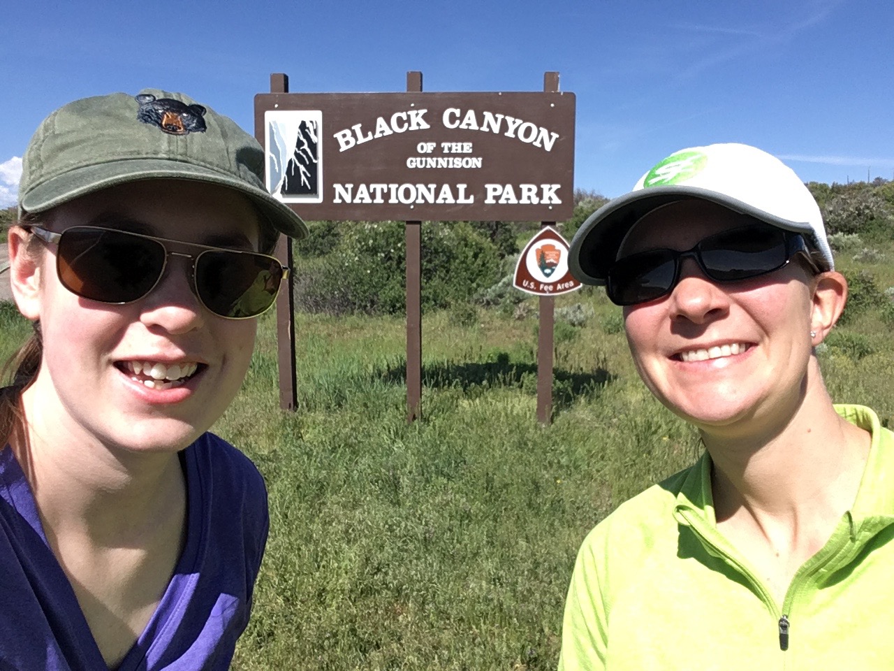
Driving into the park! This is only the second national park I have visited, besides the Great Smokies.
The Black Canyon of the Gunnison National Park, established by Congress in 1999, encompasses 14 miles of the canyon's total length (48 miles.) The park also includes a designated wilderness area. The Black Canyon is one of the least frequented of America's national parks, with only 181,689 average annual visitors in the last ten years.
The canyon reaches a peak depth of 2,722 feet at Warner Point, but it is not the deepest canyon in North America. That honor goes to Hell’s Canyon on the Oregon-Idaho border, which plunges to 7,913 feet.
What makes the Black Canyon unique is its narrowness and darkness. At the river location dubbed the Narrows, the canyon's width is only 40 feet. At the rim, the narrowest point is the Chasm View, at only 1,110 feet. With short distances like these, there is a small window for sunlight to penetrate the canyon.
Hiking the inner canyon is strenuous, dangerous, and ill-advised. There are no trails into the canyon, meaning that rock climbing/rappelling descents are required. Becoming "cliffed out" is common. The river is not easily traversable by kayak or raft. Additionally, poison ivy grows along the river, up to five feet in places. Thus, only 3% of the park's visitors attempt an inner canyon backpacking experience.
Hiking the rim is more pleasant and affords classic, Ansel-Adams, Western landscape views.

Hitting the trail.
We set out on the North Vista Trail from the North Rim Ranger Station (approx. elevation 7,700) just before 10:30. Our destination was Green Mountain, a moderate seven-mile round trip trek that would offer us incredible inner canyon views and take us through a variety of high desert plant life. Backpacker Magazine even rated this trail one of the "best hikes ever" in 2010.
It was already a warm day and we were expecting temperatures to climb into the high 70s. We began right from the ranger station, through an open, knee-high field of sage and oak brush. A sign informed us that we were entering the designated wilderness area.

Patrice examines the wildflowers.
Dozens of multi-hued wildflowers dotted the trail. Patrice identified purple lupine and crimson Indian Paintbrush, but we wondered about the yellow blooms.
The trail quickly left the open field and followed a gradual path into a pinyon-juniper forest. We appreciated the solitude of the trail. Even though it was Memorial Day weekend, we saw only a few small groups heading out on a hike.
We largely had the trail to ourselves, and when our conversation lapsed, the silence of the backcountry enveloped us. I was impressed by the lack of sound intrusion from cars circling the rim drive, and the general absence of human impact.

The overlapping canyon walls constantly look like they are caving in on themselves, crushing the open space.
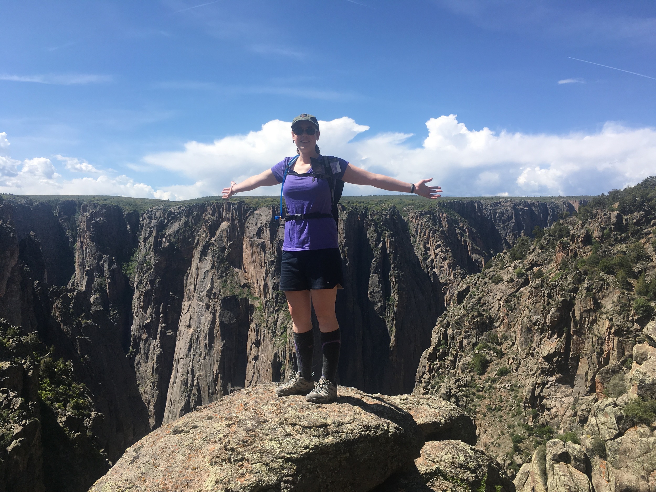
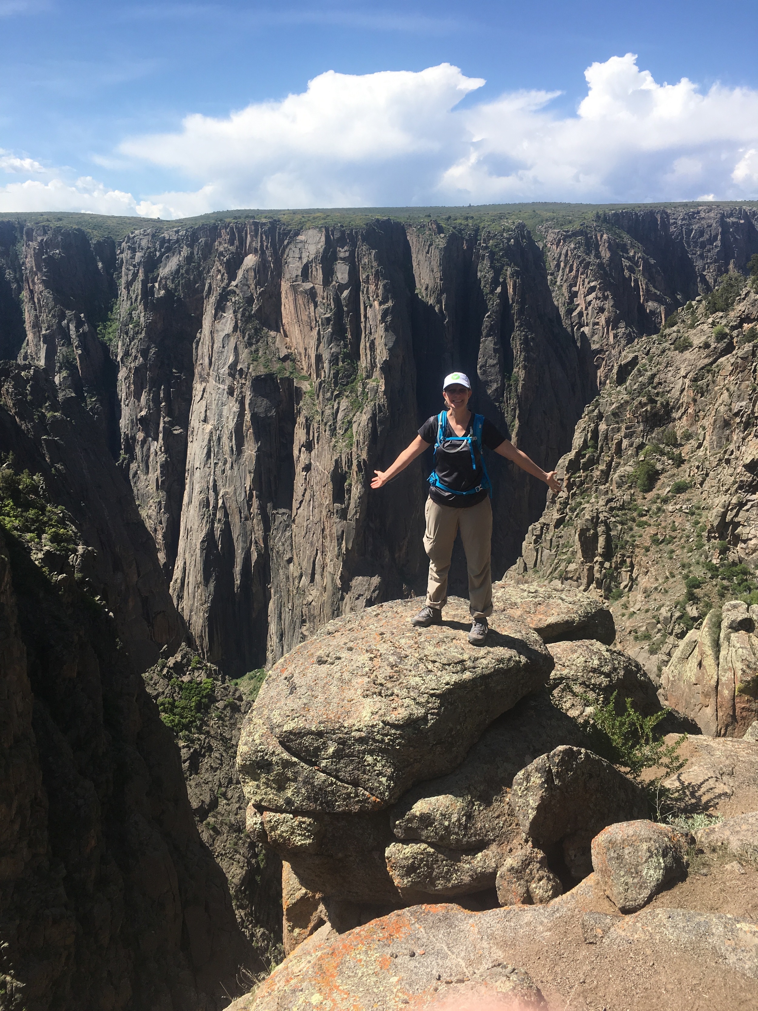
It did not take long to find beautiful vantage points. We took in the steep drops as we came to one of the most distinct features on the North Rim, the Painted Wall.
This towering cliff reveals striking color striations that run down the rock face like lightening bolts.

Distant view of the Painted Wall.
The Painted Wall is also the highest cliff in Colorado. At 2,250 feet, it easily dwarfs several man-made structures around the world.

NPS diagram showing the Painted Wall in comparison to world monuments. Left to right: Great Pyramids, Cairo, Egypt, 449 feet; Washington Monument, Washington, D.C., 555 feet; Eiffel Tower, Paris, France
1,063 feet; Empire State Building, New York, 1,250 feet; Willis Tower (formerly Sears Tower), Chicago, Illinois; 1,450 feet; Tokyo Sky Tree, Tokyo, Japan 2,080 feet; Burj Khalifa, Dubai, United Arab Emirates, the tallest building in the world at 2,717 feet.
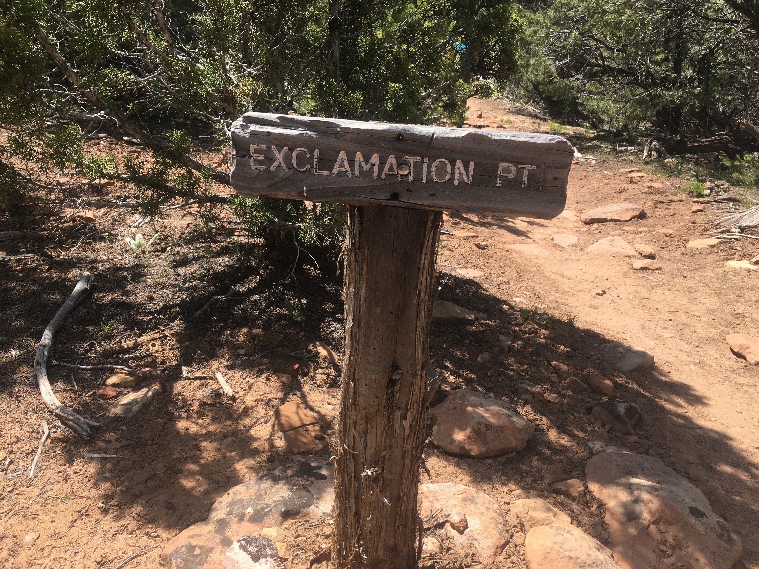
We soon reached the turn for Exclamation Point, only 1.5 miles from the ranger station. We followed the lasso-shaped spur trail to find some of our favorite views of the day.
The appropriately-named Exclamation Point gives you a cross-canyon vista, a long shot of the Gunnison River, a glimpse into the foreboding canyon depths, plus a 180 panorama. It does not disappoint.
We took turns posing and getting a birds-eye view of the green Gunnison River coursing through. Perched high above the river, we tried to discern how fast it was moving. It looked gelatinous and immobile from this distance, though we knew it must have been rushing fast. After all, this powerful hydraulic force had hollowed out this canyon over millions of years.

We continued on, with two miles to go before reaching the trail's terminus. En route to Green Mountain, the trail closed in a bit, offering some tree cover and relieving shade. Things also took on a green and blue hue, as we entered what felt like true forest, with interesting tree formations.
The views were slightly obscured, but occasionally we would round a bend and find a surprise. We saw very little wildlife, only a few lizards and the rustling of birds. Sadly, we did not spy a falcon, but we suspect we saw a hawk.
The last half mile or so to Green Mountain became strenuous. We began to feel the elevation pick up. Exposed to the midday sun, we were definitely sweating.
We finally reached the "top," though it is not a true summit, at noon. We glimpsed far-away mesas, plateaus, and snowy peaks. Trail notes informed us that we were looking at a hearty sampling: the San Juan Mountains, the West Elks, Grand Mesa, the Uncompahgre Plateau, and an aerial perspective of the Black Canyon.

Aerial shot. We were surprised by the greenery!

Distant views from the top of Green Mountain.
We had hiked Gunnison Gorge the week before, and we could now see the geographic relationship between the Black Canyon and the gorge (the river flows northwest from the former into the latter.) The distant views were far more arid and spread out. We were surprised at the greenery of the canyon, compared to those far-off red lands.
We sat on some sun-exposed rocks and enjoyed a snack. As Colorado weather is wont to do, conditions began to change quickly. Afternoon storm clouds gathered in the west.
We decided to get going, after only 15 minutes or so at the top of Green Mountain.

Discoloration and true black-canyon walls.
Thankfully we were not drenched during our descent, but we did enjoy the cloud cover that cooled us down. The shade also revealed hidden color variations and rock differences that we were unable to see in the harsh midmorning sun. Painted Wall came alive.
The descent was quick, aided by the forgiving breeze. We reached the car at 1:45 and decided to take a quick jaunt on the rim drive.
We were utterly floored by the Balanced Rock and Big Island overlooks. These vantage points offered even deeper views into the canyon and unique angles of rock.

In his book, Images of America: The Black Canyon of the Gunnison, Professor Duane L. Vandenbusche of Western Colorado State University writes,
"Some canyons of the American West are longer and some are deeper, but none combines the depth, sheerness, narrowness, darkness, and dread of the Black Canyon."
Dread is an accurate word. Along the rim hikes, there are no guardrails to hold you back from the cliffs (though there are railings along the rim drive pullout points.)
Peering into the void, the sheer drop is intimidating and disorienting. If you fell, there would be no ledges to catch you. Everything looks twisted, dangerous, and isolated. It seems nearly impossible to navigate the canyon floor below, which is gnarled with thick plant growth.
The previously gentle breeze had now gathered to 30 mph, and we definitely had to hold on to our hats. We snapped some pictures at the rim drive overlooks and returned to the shelter of the car.
Raw natural forces are at work here, and hikers should use caution. The fear added to the thrill of the journey, and also reminded us of just how wild some places still are.