Three Lakes Trail: A Classic Colorado Hike
My first splash into an alpine lake was chilly, but not as cold as expected. When I came up for air, I felt all the nerves on my skin protesting, warning me to get out of this frigid basin of recently melted-snow. But I wanted to stay suspended for just a moment longer. Blue water, blue sky, blue veins. All around me was this color of life, and I drank it all in.

I couldn't leave Paonia without one last hike. It had been a month since Patrice and I hiked the Black Canyon of the Gunnison and I was itching for the trail. I happened to run into Sam, one of my Paonia pals, and he asked if I had any bucket-list items for my last few days. Immediately, I said "a hike." Sam suggested Lost Lake, up Kebler Pass heading toward Crested Butte. Off we went on Sunday, three days before my time at Elsewhere expired.

Entering Gunnison National Forest.

Along the Kebler Pass Drive.
The drive was half the thrill. We took the same route that Patrice and I did on our first hike to Dark Canyon, two months ago. We started north on Highway 133 out of town, and after 15 miles, banked right onto Colorado Road 12 and into the Gunnison National Forest.
Patrice and I were only able to go as far as Erickson Springs, but now Sam and I were able to continue onto Kebler Pass.
Due to its high elevation of 10,000 feet, Kebler is closed until June, when the snowpack finally recedes. I can imagine how different it would be in winter, but this road of twists and turns was breathtaking. Every ridge delivered new mountain views. To our left was Marcinella Mountain, to our right were the Beckwith Peaks and Mount Gunnison.

Driving along Kebler.

Aspen grove.
Another 15 miles took us to the junction of C.O. Road 706, the last stretch. We drove alongside aspen groves, my first up-close glimpse at this remarkable tree. Aspens typically grow in large colonies and are derived from a single seedling. The trees grow an interconnected root system that can survive forest fires, allowing aspens to grow and thrive despite adverse conditions. There is an aspen grove in Utah called “Pando” that is estimated to be 80,000 years old, making it possibly the oldest colony of aspens. It is also the largest living organism in the world.

Hitting the trail!

The last few miles to Lost Lake Campground were bumpy, but we made it. We decided on the Three Lakes Loop, which begins right from the campground on the shore of Lost Lake Slough. The campground is rated one of the most scenic in the state, and it's easy to see why.
Right from the trail, we were blown away. The trail begins in a wildflower meadow, with views of the Ruby Range, before entering a forest of aspen grove and spruce firs.
At 9,600 feet elevation, the temperature was cooler than in Paonia, but the sun was stronger, so we appreciated the tree cover.

Sam admires the view at the start of the trail.

Sam vs. the mountain.
We switchbacked for the first little while and got some good views of the aspens. I was disappointed to see so many of the trees defaced with lovers' initials and other markings that had stripped away the beautiful, white-brown bark.
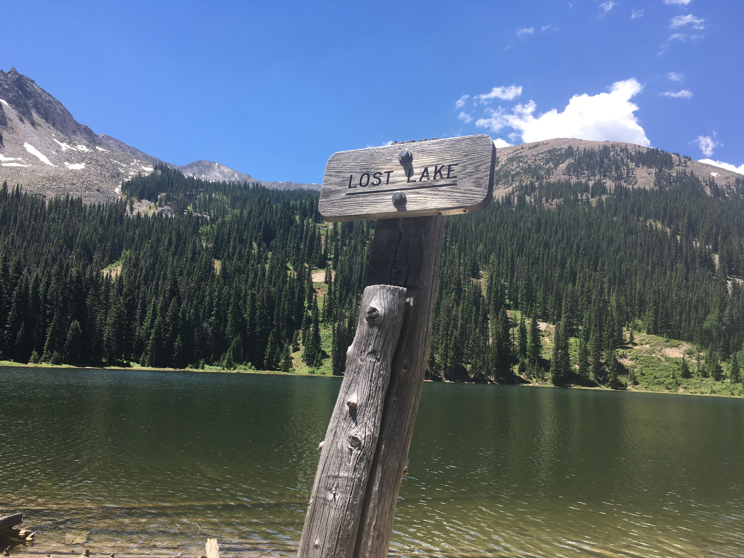
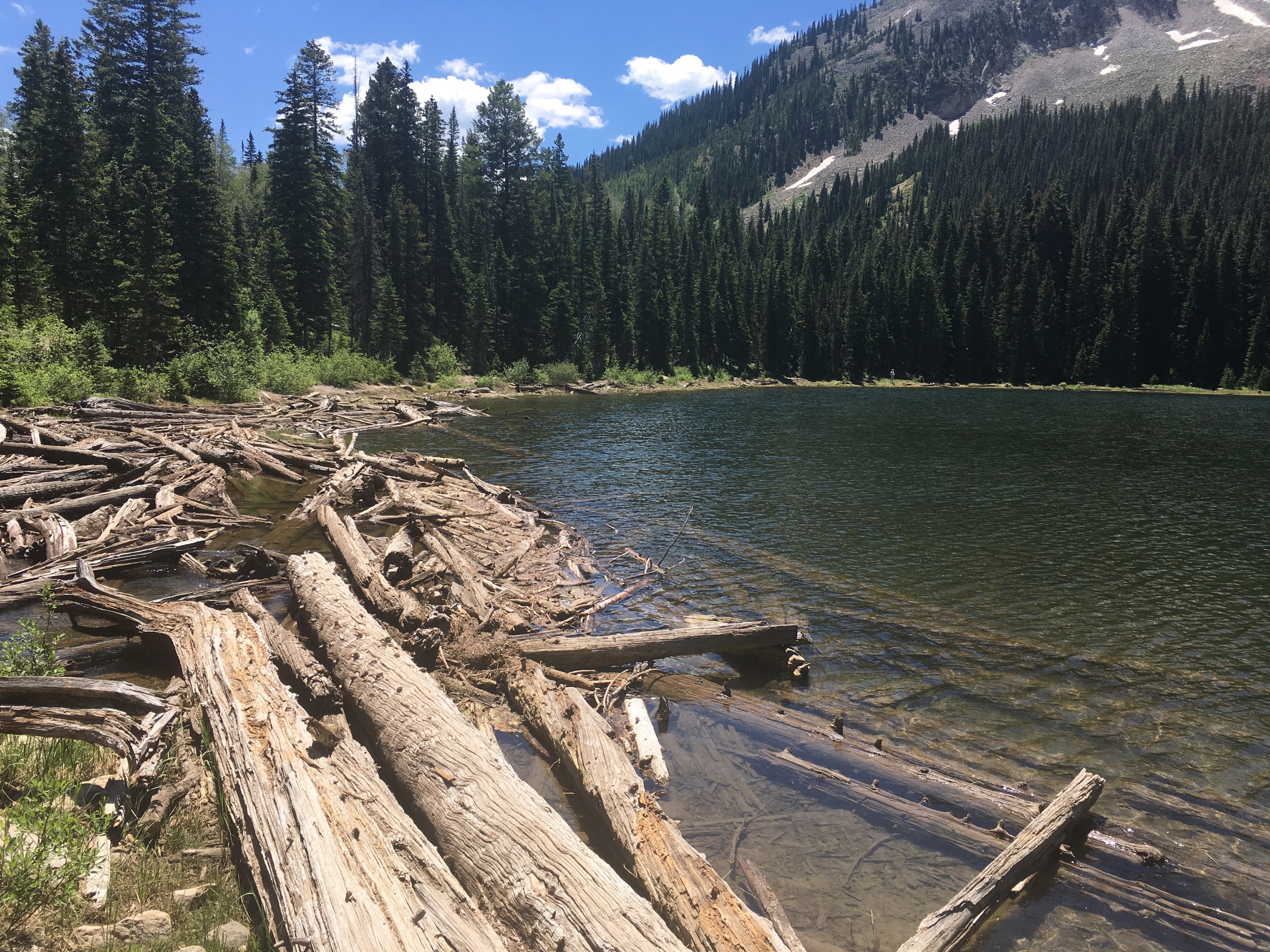
We spied a small log dam, and looking upstream, we could see Lost Lake, the first of the three. We hurried along.
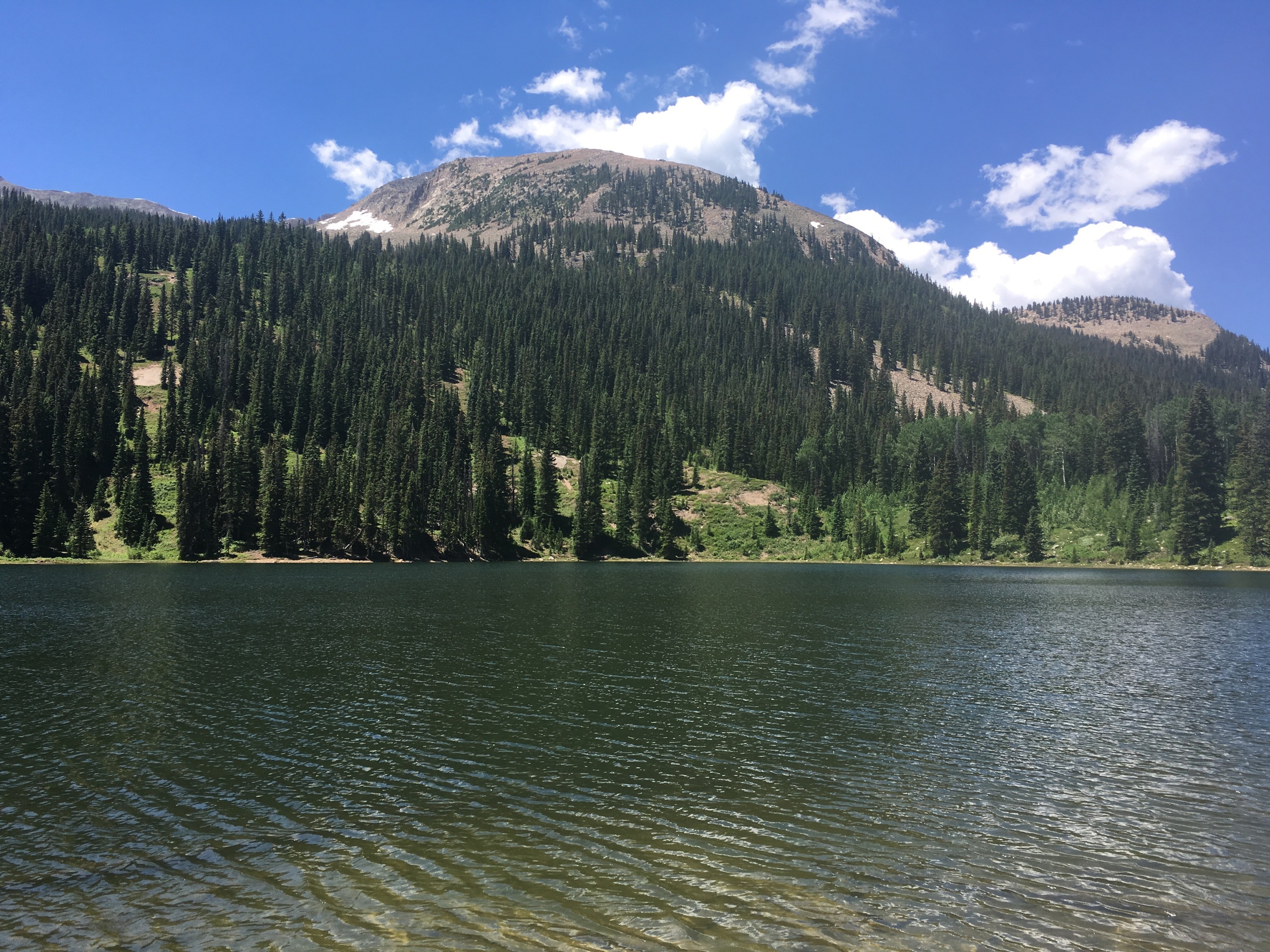
When we reached the shore, I thought, "this is what I came for." It was a classic Colorado vista: a green-blue lake with a gentle sandy shore, jaybird sky, and two mountain peaks framing the scene.
We took off our packs and walked along the shore, snapping pictures. I was already in awe, but Sam reminded me we had two lakes ahead of us.
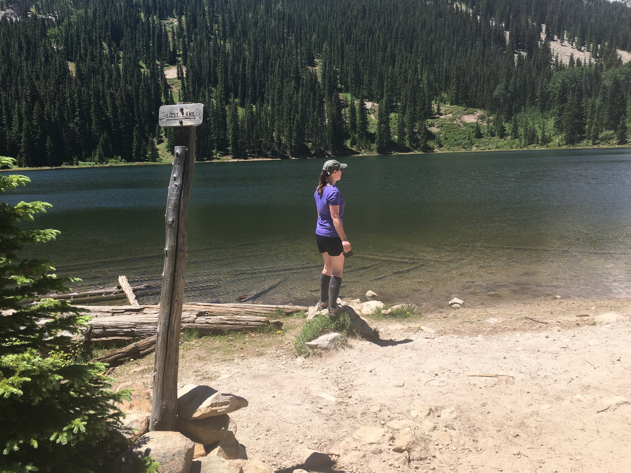
Apparently there are backcountry campsites on the far side of the lake, but we didn't venture to explore them. These lakes are also quite popular for fishing, and one woman was casting her line a-ways down the lake.
To hook up with the trail again, we had to make a log crossing. It was a fun obstacle to slip and slide along. Once over the logjam, we continued to climb through dense forest and spied some baby aspen growing in.

New bright-green growth on a young aspen.

Middle Creek Falls.
We also came to a small waterfall, Middle Creek Falls. There wasn't a clear trail, and climbing would have involved a lot of wet-rock scrambling, so we opted to admire rather than scale the falls.
Save for the fisherwoman at Lost Lake, we had total solitude during this part of the trail. It was quiet and still beneath the trees, and easy to get lost in our own thoughts. But every now and then, we would break into a clearing, eyes drawn to the treetops.

Very dense forest covered much of the trail, but we also got some nice sweeping ridge-line views every once in a while.
We soon reached an overlook with magnificent views of the West Elks, and the blue speck of Lost Lake Slough below. It became my favorite view of the whole trek. It was like a postcard, perfectly framed, with receding peaks in the background and tall trees in the foreground, buoyed by a blue sky.

One of the best overlooks I've ever seen. And this wasn't even a summit!
At this point, we were quite close to Dollar Lake, and once we broke through to the clearing, the lake all to ourselves, we knew we'd found the perfect picnic and swim spot. We were greeted with a perfect mirror-image of the mountain on the lake's blue-green surface. The mountain sloped gently, in a perfect bird's wing plane, to the shore, which was dotted with pockets of sandy beach and thickets of spruce or pine.

Panorama of Dollar Lake.
We skipped over to the far side of the lake, unfurled a blanket, and unpacked our lunch spread. Sam had brought tortillas, beans & rice, tomato, and avocado. I had packed apples, peaches, and cheese. We made some trail tacos and sliced up some fruit, enjoying the break and chatting about the journey so far.

A perfect, glassy reflection at Dollar Lake. We dove in. Cold, but worth it!

Mountain views, and a sliver of snow to the left!
We couldn't pass up the opportunity to swim in these pristine waters, so we skirted the lake's circumference looking for the perfect spot, eventually ending up back where we started (of course.) It would have been hypothermic in May or even early June, since snow would still be melting, so we were unsure what we were in for.
I went in first, misled by the relatively warm shallows, and was rudely awakened by the snap of cold, alpine water when I dove under a little further out.
As I rushed back out, flailing and screaming, Sam took off for the middle of the lake, windmilling his arms to try to keep some semblance of warmth. It didn't last long, and he soon joined me back on shore. We were dripping wet, but totally invigorated.
We dried off and began the descent to Lost Lake Slough, which would complete our loop. This part of the trail was much steeper and rockier, serpentining its way down. We eventually crossed Middle Creek again before briefly joining up with the Beckwith Pass Trail. Here, we got one of our best shots of the day:
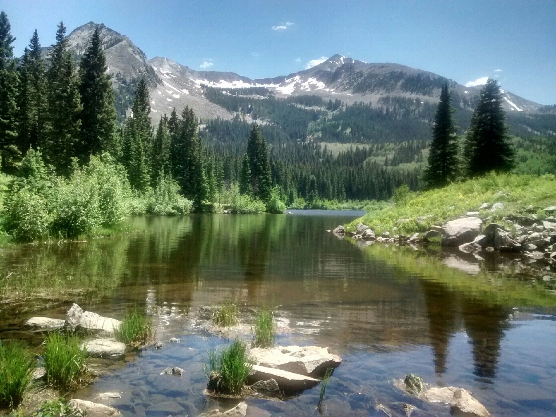
Photo credit goes to Sam for this epic shot of the Beckwith mountains and Lost Lake Slough leading into a little creek crossing. What a way to end the trail!
We made our way back to the parking lot, giddy and all smiles. While the trail was only a little over 3 miles, and was generally flat and easy, it still felt like a grand accomplishment. This was a perfect hike to end my time in Paonia. A beautiful and breathtaking (literally...hello 10,000 feet!) trail to high alpine lakes, and my first Colorado swim.