
Hiking the Dark Canyon Trail
I was yearning for outdoor adventure. I had been in Colorado for nearly two weeks and had yet to hit the trail. With Mount Lamborn looming over Paonia and other peaks rising in the distance, I found my eyes drawn outward and onward. Luckily, one of my fellow residents is an avid backpacker, hiker, and all around adventure-woman.
Patrice (who backpacks frequently and lives a semi-nomadic lifestyle with her husband, Justin) did some research. We wanted to go somewhere reasonably close by for a quick half day hike to get the lay of the land.
Colorado does not suffer from a shortage of outdoor beauty. There are 42 Wilderness areas in Colorado; four national parks (Black Canyon of the Gunnison, Great Sand Dunes, Rocky Mountain, and Mesa Verde;) two national recreation areas; and 11 national forests. Not to mention the numerous national grasslands, historic sites, and scenic byways.
Some options near Paonia are the Black Canyon of the Gunnison National Park and the Dominguez-Escalante National Conservation Area. The Black Canyon is just what it sounds like: a deep, dark, craggy canyon that is far less frequented than the Grand Canyon. The Dominguez-Escalante region is entirely different. Akin to Southern Utah, this wilderness area offers towering red cliffs and ancient Native American dwelling sites.
Wanting to save those for a longer day trip, we settled on the Dark Canyon Trail in the Raggeds Wilderness area of the Gunnison National Forest, a mere 45 minute drive from Paonia.

On the trail!
The Raggeds Wilderness spans both the Gunnison and White River National Forests in a 65,443 acres swath. Elevations range from 7,000 to about 13,000 feet. The name is accurate, as the terrain really is ragged and rocky.
We set out from Paonia at 11:00 am, traveling north on Highway 133 for about 15 miles. We were on the West Elk Scenic Loop, a 205 mile drive that takes you through several mining towns, ski communities, and offers those sought-after mountain views. We were only on a short stretch, but it was undeniably beautiful.

West Elk Loop. https://www.codot.gov/travel/scenic-byways/southwest/west-elk-loop
We continued to County Road 12, also called Kebler Pass Road. Kebler Pass itself, leading to Crested Butte, is still closed for the season, but our section would be accessible. Accessible... but still a little rough. The road turned to dirt, which in the spring translates to mud. Patrice's Subaru performed admirably and thankfully we had no problems.

Spectacular mountain views at Erikson Springs Ranch.

We took the Horse Ranch trail, which brings you into the heart of the canyon.
We drove east for six miles until we reached Erickson Springs Ranch. We turned left into the recreation area of the same name, where we found a few campsites and picnic spots. We parked at the trailhead and we relieved to find no other cars there. We hadn't seen anyone on the road (except some deer) since turning off the main highway.
For a sunny day in the high 50s, it was still chilly. I was glad to have a long sleeve thermal. We chose the Horse Ranch Park trail. The full trail is 13 miles one way, but simply decided to walk as far as we liked.
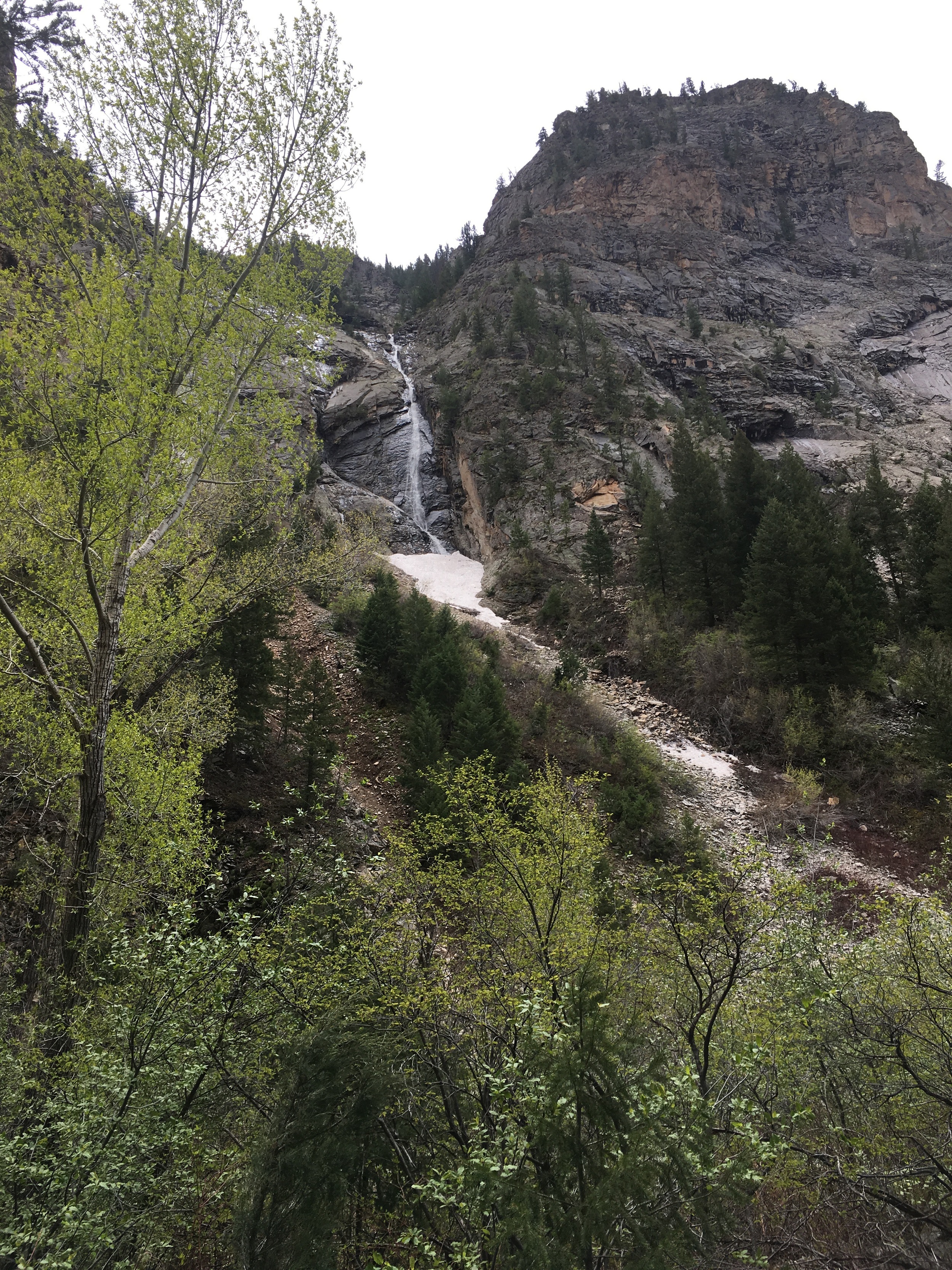
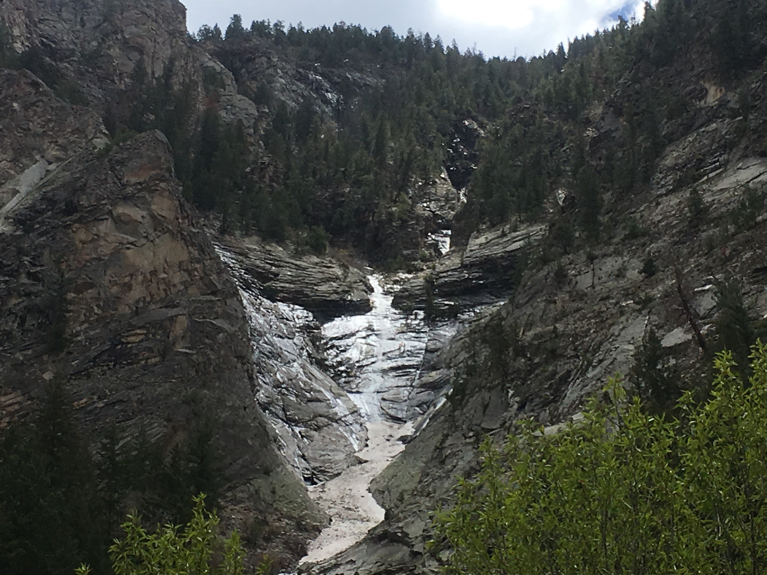
Anthracite Creek passes through the Dark Canyon, but this time of year it is more like a river. We came upon it early on and we immediately struck at how high, and fast, the water was.

Anthracite Creek, or more accurately, river.
Melting snow causes creeks, streams, and rivers to surge this time of year. Crossing would be dangerous and likely impossible without the bridge that had been built, so we were glad to take the easy route. It's also an ideal place to stand and admire the full view of the canyon, as well as the array of alpine trees.

The bridge is a perfect spot to take in the surrounding canyon and get a 360 view.

After crossing the bridge, the increasingly narrow trail took us under forest cover. The trail was flat, allowing us to walk at a comfortable pace and chat. To our left were steep and craggy cliffs, the rocks both bleached in places and scarred in others. To our right was a green treeline.
Heading deeper into the canyon, we hopped a few puddles and scrambled along a few rocks. The creek rushed to our right, and we remarked at how loud the water was, how it deadened any other sounds. We passed a few dispersed (and, technically, illegal) campsites tucked near the riverbank, but we were the only ones in the woods this day. I was glad we chose to hike on a Wednesday. We had the place to ourselves.

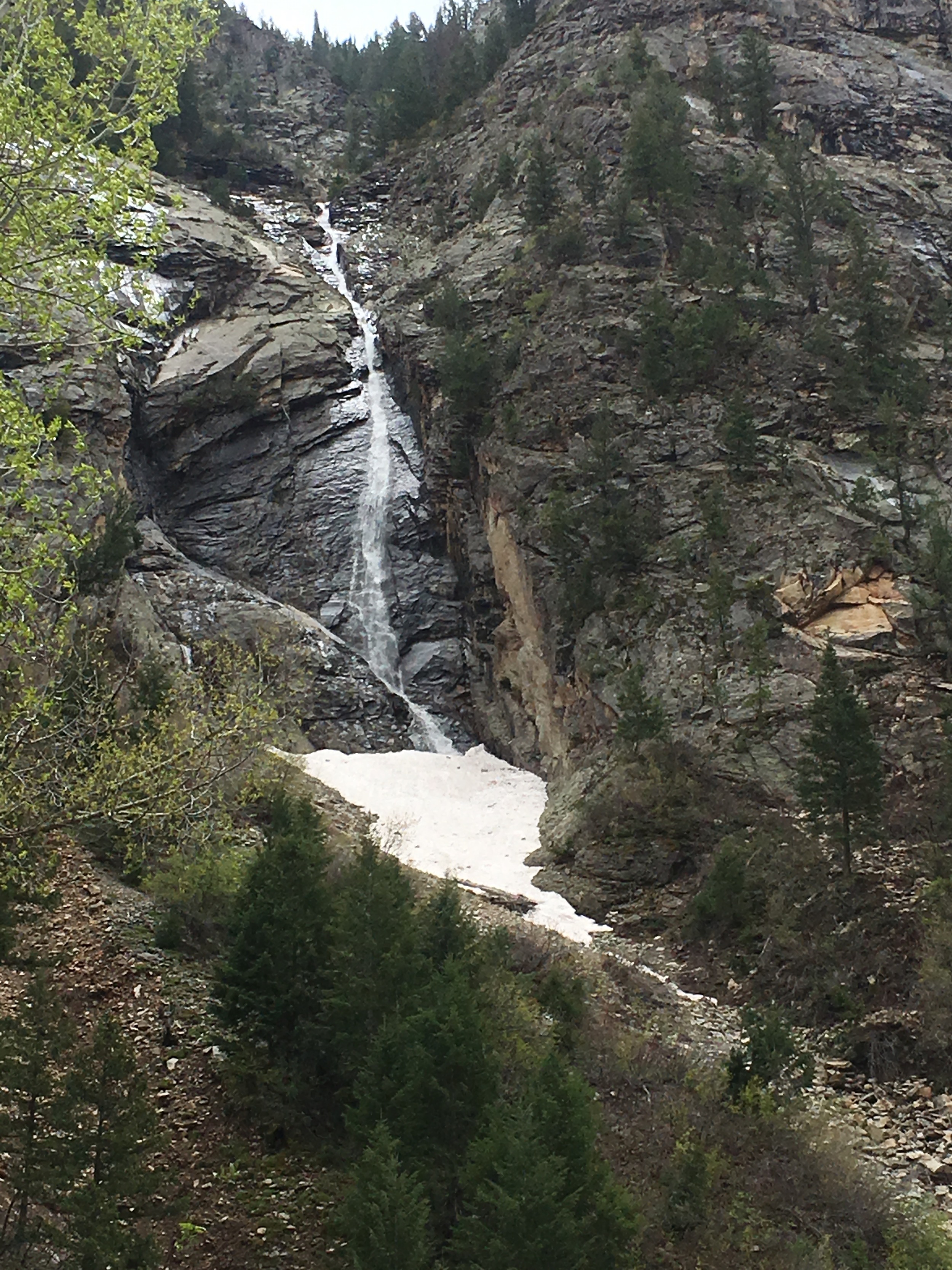
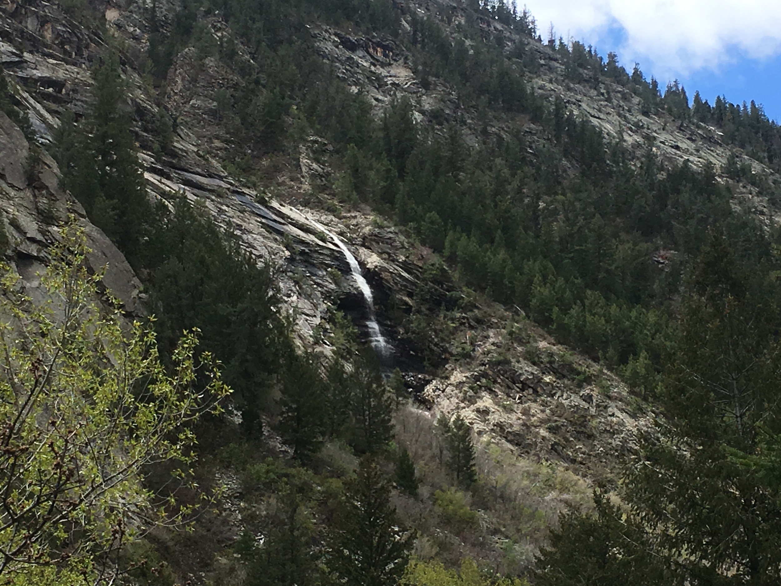
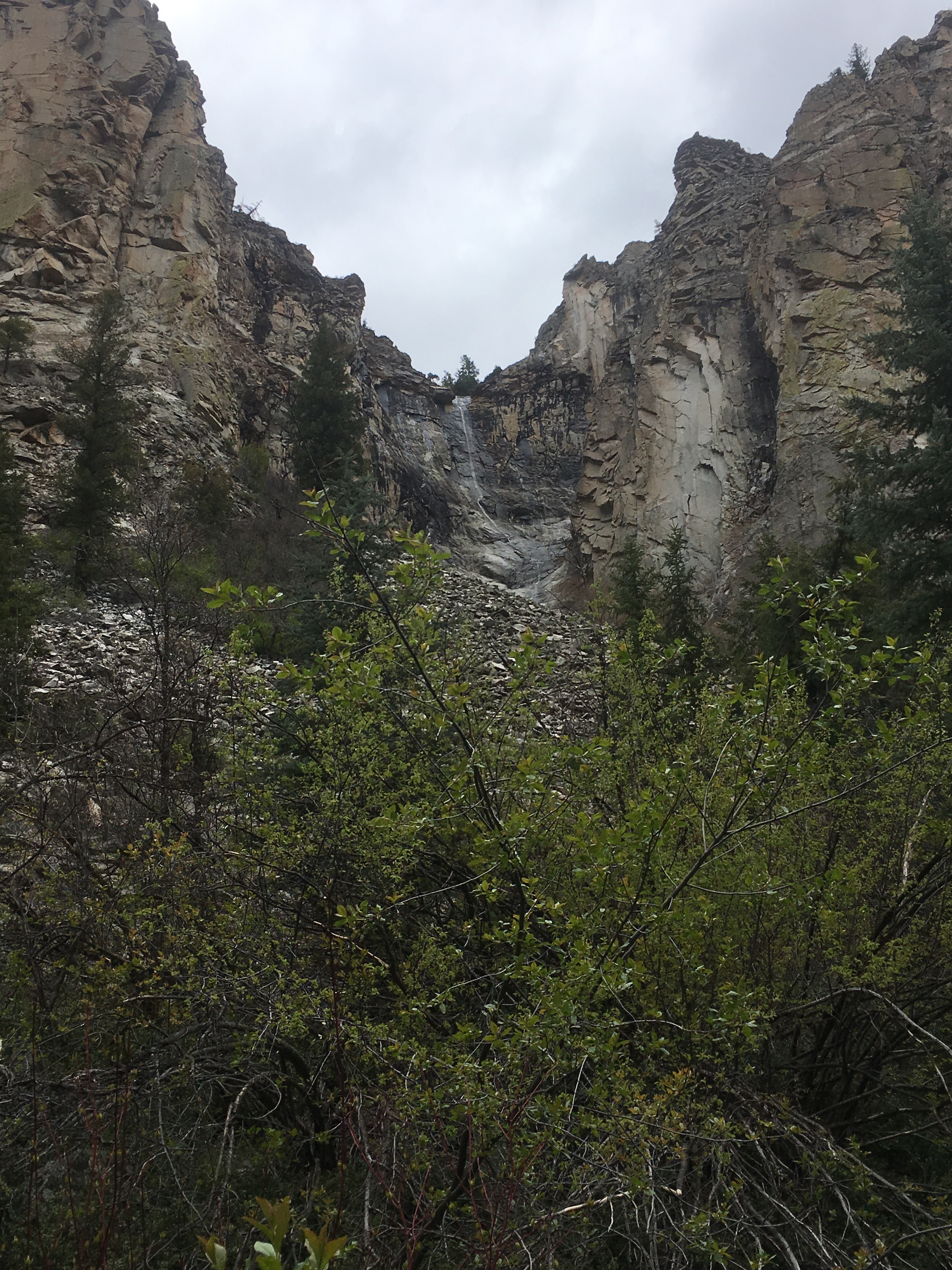
We spied several tiny waterfalls meandering down the canyon walls. The water caught the light, moving in slow, silvery strands down the rock faces. Made from melting snow, these waterfalls are a special gift of spring, and we were glad to have caught them. Many of the falls were so small that we skipped past them, only to look back around a bend further up the trail and catch them from another angle.
We went about two miles and decided to turn back, for a total of four. Heading back, Patrice remarked that now we knew why it was called “dark canyon”- with just a quick movement of the clouds, we lost much daylight being so far down and under tree or rock cover. We encountered a spot of rain and pressed on a bit faster.
Along the way, I heard the telltale rattler, but didn’t actually see the snake. I did, however, see a small gray one (I didn’t know the species) slink away on the rocks just to my right. I felt the hair raise on my neck and picked up the pace.
Patrice relayed some stories of snakes and other critters (mice, spiders) who frequent the backcountry shelters on the Appalachian Trail. In some shelters, she and her husband pitched their tent anyway, to keep the night visitors at bay. I said I'd rather face a mouse than a snake; she said the reverse.

Happy hikers.
Reaching the end of our journey, we snapped a picture on the bridge, admired the trail one last time, and continued back to the parking lot.
Dark Canyon was an easy, accessible trail. We would have been happy to explore further along the trail, but four miles gave us a good taste. With an impressive river, interesting rock formations, waterfalls, and forest features, it was the perfect introduction to Colorado hiking.